Middle Prong Loop

Hike #24 : September 20, 2014


Middle Prong Loop (Middle Prong, Greenbrier Ridge, AT, Miry Ridge, Lynn Camp)


22.4 miles
16.9 new miles
334.7 total overall miles
234.9 total miles of 800.8


When originally considering this hike, I decided it was too ambitious at my current level of hiking. But at 9:30 the night before we were to hike Roundtop Trail, I changed my mind and sent Eddie a text to meet up at Tremont the next morning. He was all too happy with that. Of course, he is insane.

Arriving at Tremont just before daybreak it was clear there had been a bit of wind overnight. Leaves and small limbs scattered to roadway. When reaching the parking lot for the Middle Prong Trail, the air was cool and it was clearly going to be a perfect day to hike.

We begin at the Middle Prong Trailhead and start by crossing a bridge and embark upon a gentle incline up a wide gravel roadway. Here we come to the first trail sign as the trail forks. Thankfully someone was nice enough to Sharpie in an arrow to the left trail indicating it as the Middle Prong. The right trail is the now unmapped Thunderhead Prong Trail.

There's a sign as the trail begins that states this as a gentle quiet walk not requiring hiking shoes. That would depend on how far you wish to take the trail. After a few miles, it gets rather rocky. In less than a half mile, we came to the first waterfall, the Lower Lynn Camp Falls. The falls look like a giant water slide and the pictures I took do it no justice. Beautiful.


Just a short way from the falls, we heard crashing water and walked a few steps from the trail where we came to the second waterfall.


And at less than 3/4 of a mile, we find the third waterfall. This is the multi-tiered Lynn Camp Falls and is simply a magnificent picturesque scene.


All three of these waterfalls are accessible to most anyone. An easy walk out and back and less than a mile and a half round trip.

After the falls, the trail continues its mild incline as it becomes quite rocky. At just under 2 miles, there is a side trail to the right that was marked by a small stack of rocks.


This trail leads just a few yards to a long abandoned rusted out old car that is said to be a Cadillac. I sure can't verify that but it is a cool sight to see in this surrounding.


At 2.3 miles, we come to the trail junction with Panther Creek Trail. We continue on Middle Prong to the right. On up the trail at 3.1 miles, we found the remains of what looked like an old homestead or perhaps a building used by the Civilian Conservation Corps. All that remains is a fallen chimney and the concrete foundation of the long gone shelter.


Nearby, there is also an old railroad rail and what appeared to be part of a stove pipe and logging cable.

At about 4 miles, we came to another subtlety marked side trail to the right. Since someone had gone through the trouble of marking it with a small pile of rocks, we decided to check it out. Just a few yards and we began hearing what sounded like another waterfall. Sure enough, we had stumbled onto the Indian Flats Falls.


Very beautiful. This picture shows the top of the falls. In the opposite direction there are two more falls. There was no clear path leading to the bottom of those falls and since we have many, many miles to go, we decided to skip trying to make our own and returned to the main trail.

In just about a tenth of a mile or so, we come to the trail junction with Lynn Camp Prong Trail and Greenbrier Ridge Trail. Since we're doing the long loop, we continue right onto Greenbrier toward the Appalachian Trail. We'll be circling around and returning to this spot from Lynn Camp later.

Once we start Greenbrier, we leave the rocky roadbed behind and begin the journey up an underused, muddy, rooty, rocky and rather unmaintained trail. This is a deep forest hike and its all uphill. Our surroundings are still beautiful but if you want views and company, this may not be a trail for you. With all the rocks, the 4.2 miles up is very strenuous at times but we finally made it to the AT. We had previously decided to take lunch at the Derrick Knob shelter. I didn't know at the time it would .3 mile straight up but that didn't stop us. So instead of continuing on our destination to the left on the AT, we go right on the AT to the shelter. We were 9.2 miles into our trip when we got to the shelter.


Its a nice shelter and we enjoyed the break. The wind from the night before had brought down tons of nuts from the surrounding trees and the chipmunks were happy to take advantage. As we had our lunch, there were dozens of the little guys running all around harvesting for the winter.

After lunch, we started down the AT and back on track. The AT soon proved to be a difficult climb. We came across a few backpackers and an ATC volunteer hard at work sawing a tree. These guys are amazing. Its hard enough just hiking the trail but they carry saws and hammers and whatever else they might need just to make the trail nicer for the rest of us.

We hiked along the AT for 3.7 miles until we came to the junction with Miry Ridge Trail to the left. Miry Ridge is another forest hike. If you like the peace, quiet and solitude of the mountains, this trail suits the bill. Its often a narrow and unmaintained trail.


As the picture shows, the trail is a bit overgrown in places so dodging the briers was a challenge. I imagine that in winter with the leaves gone, there would be some nice views as the trail continued along the top of the ridge. Still, we got glimpses of some real beauty through the trees.


After two and a half miles, we come to the junction with Lynn Camp Proing Trail. Going right would continue on Miry headed toward Jakes Creek and Elkmont but we're going right on Lynn Camp and heading back toward Greenbrier and Middle Prong. For the next 3.7 miles, the trail meanders mostly downhill through the forest. Eventually the trail turned into a rocky path that my sore feet found most unwelcoming. Finally we come to the junction with Greenbrier and head back the way we came. We ended up with 22.4 under our belts.  Exhausted, I was so happy to get back to the parking lot!

What a great day of hiking and what an accomplishment for us both!

Happy Trails!

TRAIL REVIEW

Middle Prong Trail - 4.1 miles
Greenbrier Ridge Trail - 4.2 miles
Appalachian Trail - 2.4
Miry Ridge Trail - 2.5 miles
Lynn Camp Prong Trail - 3.7 miles
Middle Prong Trail - 4.1 miles

Derrick Knob Shelter


Wanna hike the 900? Start by checking out the book Day Hiker's Guide To All The Trails In The Smoky Mountains by Elizabeth L. Etnier.

For more pictures of this hike, check out the Smoky Mountain Hikertrash facebook page.

Boogerman Loop

Hike #23 : August 29, 2014


9.5 miles
7.5 new miles
312.3 total overall miles
218.0 total miles of 800.8


I was a little concerned  about this trail after reading many of the footbridges were washed out or otherwise destroyed, including one that is believed to be the longest in the park. Last weekend's prediction of heavy rain seemed to make things too risky without more information but after a hot and dry week, today's the perfect day!

After a two hour drive, I arrived at the trailhead to Caldwell Fork Trail where I'll be starting my hike. Just about a mile from the trailhead a bear darted across the road in front of me. Always a good sign! A quick look at the trail and there's the footbridge. Guess I won't be getting my feet wet just yet.


The trail starts off meandering through the woods for .8 mile where it comes to a fork. Staying right would keep you on Caldwell Fork and a left turn starts Boogerman. I decided to go left. Here was the first non-bridged creek crossing. I decided to take my chances and walked across a fallen tree instead of changing into the sandals this early in. No problems.

Almost immediately the trail starts its incline. Its a good trail. Not a lot of roots and rocks and the usual beautiful surroundings of the Smokies. There's an abundance of huge trees all along the trail. Stories abound that Robert Palmer (aka Boogerman) was the most stingy of all the settlers in the Smokies when it came to the timber on his property. It was common and profitable for settlers to sell logging rights but Palmer would have none of that and thus the old growth forest we have here today can be attributed to that fact. Thanks, Boogerman! After just over 2.5 miles, the trail gives me one last massive hill to climb before taking a turn downward. From this point on, the hike is mostly easy to occasional slightly moderate climbs. There are several stone walls, one of which is the biggest I've seen on trail to this point.


Since the trail is relatively short, I decided to check out any and all side trails. Often an unmarked side trail can lead to cemeteries and, as I've said before, I really enjoy that. The first side trail took me steeply up to what actually looked like a grave yard with no graves. No stones, no markers. Just a small round patch of well maintained grass. Hmmmm? After a little post hike research, turns out this is actually the Carson-Messer Cemetery. The second side trail was near a stone wall and a fair distance away I found the second cemetery of the day. This is the Palmer Cemetery. Four unmarked stones surrounded by a serious barbwire fence. I really get the impression that the old Boogerman lived up to his nickname. Pretty cool!


At one point as the trail travels down, it basically walks you directly into a giant hollow tree. Big enough for my 6 foot 2 frame and backpack with room to spare.


At 4.7 miles, Boogerman runs into Caldwell Fork again. To continue the loop you take a right and soon cross a half collapsed footbridge. Since I'm in search of the 900 miles, I turn left up Caldwell to get the half mile to the junction with Big Fork Ridge and McKee Branch. After reaching the junction, I turn around and head down Caldwell Fork again. Someone has been busy cutting the grass along the trail and they've done a tremendous job. One particular fallen tree had been sawed and tagged indicating the age of the tree.


With about two miles remaining on the hike, I come to the next bridgeless water crossing. This time I gladly replace the hiking shoes for sandals and head in. As cold as the water is, it feels amazing on tired hiking feet! Since the trail is winding down, I leave the sandals on and bypass the next several footbridges in favor of wading. About a quarter of a mile from the end of the trail, I spotted a bear cub just a few feet off the trail. As I stopped, it took one look at me and poof, it was gone. I'm always amazed at how they take off in an instant and there's no trace of them, no sound... nothing.


Overall, this is a wonderful trail. I'd say its one of my favorites. I have a lot of favorites. With all the water, I'd recommend it as a summer hike but I'd definitely recommend it!

On a side note, I also recommend a drive around Cataloochee after the hike. The park has put a lot of work into fixing things up and there's a lot to see. Palmer House and exhibit, Palmer Church and cemetery, the Cladwell house, cemetery and barn along with another church and school house all in a relatively small area. Saw a lot of fat turkeys walking around. There's also a lot of Elk signs around but, alas, I still didn't see an elk. Maybe next time.

Happy Trails!

TRAIL REVIEW

Caldwell Fork Trail - .8 mile
Boogerman Trail - 3.9 miles
Caldwell Fork Trail - .5 mile out .5 mile back
Caldwell Fork Trail - 2.7 miles

Cataloochee Campground


Wanna hike the 900? Start by checking out the book Day Hiker's Guide To All The Trails In The Smoky Mountains by Elizabeth L. Etnier.

For more pictures of this hike, check out the Smoky Mountain Hikertrash facebook page.

Meigs Creek

Hike #22 : August 16, 2014


11 miles
10.1 new miles
302.8 total overall miles
210.5 total miles of 800.8


Eddie and I met at The Sinks this morning and dropped a car there and drove on to Elkmont to begin our hike from the Jakes Creek Trailhead. We got close up to a good sized bear along the side of the road just before reaching the parking lot. It's gonna be a good day.

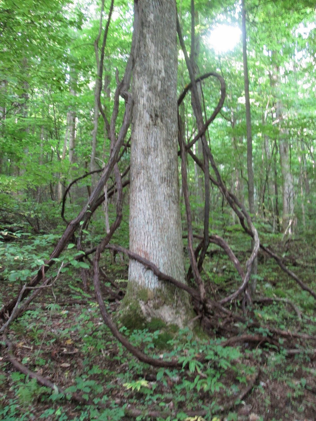
Jakes Creek Trail winds up a partially paved and gravel road for .8 miles before coming to the junction with Meigs Mountain. Jakes Creek Trail continues on up to the left so we merge right onto Meigs Mountain. The trail's is soft and wide as it rolls gently in a mostly downward fashion. I really like this trail. A lot of tall trees and huge vines with very little undergrowth to impede upon the trail. Its August and there's lots of spiderwebs everywhere. I'm pretty sure that's one of the main reasons Eddie wants me in front.


It was somewhere along the way when I saw a partially destroyed hornets nest dangling perilously over the trail. It looked kinda cool so I leaned over to check it out and maybe snap a quick picture when I noticed movement. I looked at Eddie and said there's still bees in... ouch. My first hornet sting in 43 years of living comes from a partially destroyed nest several miles into the forest. Awesome. As we quickly made our way on down the trail away from the bees, we came to our first cemetery of the day. A small community cemetery with rudimentary stones and sunken graves which as far as I can tell is called Meigs Mountain Cemetery. We snap a few pics and I complain about the pain my buddy the bee gave me in my upper right back and we continue on.


At the five mile mark of Meigs Mountain, we come to the junction with Meigs Creek Trail and take a right. This trail is a complete change of environment for us. We go from dry with little undergrowth to wet with tons of undergrowth including lots of briers and my old friend the stinging nettles. This will also be forever remembered as the trail where I saw my first copperhead on a trail. I stepped right over it but fortunately Eddie saw it and yelled something along the lines of WHHHOAAOONNGHHH! and we stopped and gawked at for a while. Beautiful little creature.


We counted a total of 22 water crossings on this trail and I'd say there would be even more after a heavy rain. I think it was after the 16th or 17th crossing that with noticed a waterfall. This was a particularly good treat since neither of us knew there was going to be a waterfall at all. Turns out its called Upper Meigs Falls or Meigs Creek Cascades but either way it is pretty spectacular.


After slipping on a rock and getting my foot wet, I decided what the heck and waded on in. The water was cold and felt terrific! The highlight of the hike. Next time I'll bring extra clothes and get under the waterfall. That would have to feel amazing after hiking for hours!

After leaving the falls, we decided to leave our water shoes on and wade the rest of the water crossings. That was a lot of fun and feeling that cold water on your tired feet is wonderful. Just 1.7 miles from the falls, we come to The Sinks and another incredible day of hiking comes to a close. Probably the easiest overall trail Eddie and I have done together and a perfect hike for a hot summer day. Very highly recommended, even just a quick mile and a half to the waterfall from the sinks and back would be a great and time worthy trip.


We did take an extensive tour of Elkmont after finishing up the days hike. The Elkmont Cemetery is a rather large one and well maintained. We also visited the site of the Elkmont Hotel and Wonderland Resort along with several historic cabins. Loved it. So to sum it all up, I looked a bear in the eyes, saw a copperhead, wore hundreds of spiderwebs, got stung by a hornet, saw lots of graves and enormous vines and got my feet wet. That's a day worth living!

Happy Trails!

TRAIL REVIEW

Jakes Creek Trail - .8 mile
Meigs Mountain Trail - 6.0 miles
Meigs Creek Trail - 3.5 miles

2 campsites (19, 20)
Elkmont Campground

Wanna hike the 900? Start by checking out the book Day Hiker's Guide To All The Trails In The Smoky Mountains by Elizabeth L. Etnier.

For more pictures of this hike, check out the Smoky Mountain Hikertrash facebook page.


Grapeyard Ridge Trail

Hike #21 : July 5, 2014


Baskins Creek to Grapeyard Ridge Trail


200  MILES!!!


11.8 miles
10.3 new miles
291.8 total overall miles
200.4 total miles of 800.8


Eddie and I got a nice cool early morning start today but were quickly thwarted by a slight error that turned out very well. Confused? So were we.

The original plan for today was to drop a car in Greenbrier and another at the Noah "Bud" Ogle Home parking area and hike the Twin Creeks Trail before moving on to Baskins Creek. Instead, we hiked the Noah "Bud" Ogle nature trail which was actually a very pleasant and short hike at only 3/4 of a mile. The confusing part was that we thought we were hiking the Twin Creeks Trail. As it turned out, the distance between the actual Twin Creeks Trail and Baskins Creek Trail is over half a mile straight up the paved road. That would not have been fun and I'm so not disappointed that we missed it.

After our nature trail side trip, we hit the Baskins Creek Trailhead on the Roaring Fork Motor Nature Trail and begin our hike. The trail takes off pretty quickly as it winds its way downhill. Its a soft trail with few roots and almost no rocks. At 1.1 miles, there's a side trail to Baskins Creek Cemetery. I've got a thing for cemeteries, so we take the trip up. Way up. Its a short walk but seriously straight up. I'd suggest taking this side trip only if you have a morbid fascination with cemeteries. Like I do.


After returning to the trail, we come to the side trail leading to Baskins Creek Falls just a quarter of a mile later. This trail is a nice well used trail also going downhill for the most part. Sweet! The falls are awesome. I've read that the settlers used to use these falls to take showers and baths. After seeing it, there's no doubt. A quick and easy climb to the middle of the falls reveals what honestly looks like a bathtub. I imagine the water to be a bit cold, so I'll wait to bathe at home... but it was tempting!


The hike back out to Baskins Creek Trail is the first real challenge of the day but still only moderately so. After rejoining the trail, we have about 1.3 miles back to the Roaring Fork Motor Trail where we'll cross the road to get to Grapeyard Ridge Trail. But first we're treated to another cemetery, Bales Cemetery. Unfortunately, it was closed for repair work but we still got a good look.


Then on to Grapeyard...


Grapeyard begins as a walk through a field past a cabin, barn and corn crib once belonging to Alex Cole. Once we enter the woods, the trail greets us with a promised steady incline. There's many huge vines along this trail that I later discovered were grapevines. Guess that explains the name of the trail. After the long climb up, the trail levels somewhat and begins rolling up and down through the forest. At 4.4 miles we came to campsite 32 where Eddie spotted a deer. Another .4 miles up and we reached the the sight of the lumber company steam engine wreck of the1920s. Seems the driver lost control and the engine rolled down into the creek which was then named Injun Creek. Seems some folks think it was named after Native Americans in the area but the truth is that its actually just a misspelling of 'Engine' Creek. Since its a creek... with an engine in it.


After lots of pictures of the wreck site, we head on out. Its 2.8 miles back to the truck from here. About a quarter mile out, I gave Eddie a surprise by jogging the rest of the trail. Surprised me, too. Just another wonderful day spent in one of the greatest places on earth. Happy Trails!

TRAIL REVIEW

Baskins Creek Trail - 2.7 miles
Grapeyard Ridge Trail - 7.6 miles

1 campsite (32)


Wanna hike the 900? Start by checking out the book Day Hiker's Guide To All The Trails In The Smoky Mountains by Elizabeth L. Etnier.

For more pictures of this hike, check out the Smoky Mountain Hikertrash facebook page.


Abrams Falls

Hike #20 : June 14, 2014


15.6 miles
15.2 new miles
262.2 total overall miles
190.1 total miles of 800.8


Abrams Falls. One of the most popular trails in all the Smokies. Most people hike to the falls from Cades Cove. Eddie and I are not most people. If there's a harder way, we will find it...

Actually, we decided to do a loop hike because we like loop hikes and we need those hard fought miles don't we? Yes. Yes, we do. After driving to Happy Valley off US 129, we came to the Little Bottoms Trailhead. We're doing the loop clockwise so we head out on Little Bottoms towards Abrams Falls Trail. Almost immediately the trail goes up, waaaay up! It's not a really long hill but definitely a difficult start to the day.


The trail mostly follows Abrams Creek and is moderately difficult after that initial hill. At 2.3 miles, the trail merges into Abrams Falls Trail. Sadly, there's still the dead remains of the many hemlock trees that were killed by the adelgid outbreak many years ago. After a couple of miles, we reach the falls around 9:30. Since Cades Cove doesn't open to car traffic until 10 on Saturdays, there was not a single person there but us. Considering that there's up to a thousand visitors a day, that was pretty cool and worth the 5am wake up call. Interestingly, Backpacker Magazine once name Abrams Falls one of the most dangerous trails in the country citing 29 deaths presumably from drownings.


After a climb to the top of the falls, a feat that seemed much easier years ago, we take some pics and continue on to the Abrams Falls parking lot at Cades Cove. This pert of the trail is so overused, it has a different feel from the less traveled trails we've grown used to. We did happen upon a couple of trail volunteers picking up trash along the trail. Don't even get me started on how much litterbugs piss me off. But anyway, once we reach the parking area we take a right to the Rabbit Creek Trailhead. It is here that I get to wade for the first time on a hike in Mill Creek. Let me tell you something, it may be 80 some odd degrees outside but that water is COLD! After the initial shock of ice shooting through my body, it actually felt pretty good on my feet after 8.5 miles of hiking.

The Rabbit Creek Trail was the surprise of the day for me as it was much more difficult than I had thought. Imagine that, right? A lot of rather steep up hills makes it feels more like a hike up Mt. LeConte. And where the hike up to here had been cool and shady, there's suddenly a lot less shade and a lot more heat. The trail itself starts off wet and rocky but dried out as we went while the rocks came and went. After the junction with Hannah Mountain Trail, we begin a merciless incline that has us baking in the sun and pushing us to the limit. At least to my limit. Finally with a few miles to go, the trail begins a nice decline leading us back to the ranger station and where we started.

A great hike. I would absolutely recommend going to Abrams Falls this way but if that's your only destination you'd be best served hiking to the falls and back instead of the whole loop.

TRAIL REVIEW

Cooper Road Trail - .9 mile
Little Bottoms Trail - 2.3 miles
Abrams Falls Trail - 4.2 miles
Rabbit Creek Trail - 7.8 miles

4 campsites (1, 17, 15, 16)
Abrams Creek Campground

Wanna hike the 900? Start by checking out the book Day Hiker's Guide To All The Trails In The Smoky Mountains by Elizabeth L. Etnier.

For more pictures of this hike, check out the Smoky Mountain Hikertrash facebook page.


For more information on this hike and many more, visit Hikinging The Smokys.

Gregory Bald

Hike #19 : June 21, 2014


17.8 miles
14.2 new miles
280 total overall miles
174.9 total miles of 800.8


We set out toward the Twentymile Ranger Station before daybreak on our journey to the amazing flame azalea fields of Gregory Bald. Today we're hiking from the ranger station on the Twentymile Trail, an easy half mile walk along a wide gentle pathway. At the trail junction, we continue to the left on Wolf Ridge. Wolf Ridge is also a rather easy stroll for 1.1 miles to the trail junction with the Twentymile Loop trail. This trail seems much less used than a lot of the trails in the Smokies but is still well maintained. For about a mile and a half, the trail works its way up steadily and then begins a downward decline to the Long Hungry Ridge Trail junction at 2.9 miles.


As we turn left onto Long Hungry Ridge, the trail winds smoothly for a mile or so before beginning a strenuous climb up toward the bald. Unfortunately, this is a horse trail. Between the recent rains and an overabundance of horses on the trail, the trail is reduced to a mass of mud and is basically destroyed. It really puzzles me as to why the park won't allow dogs on the trail due to the harm they could due to the trails and yet allow 1,000 pound horses free reign. I don't get it. But anyway, after trudging several miles up, we begin the final few steps to the bald.


The bald was surprisingly overcast and the azaleas were less bloomed than we'd hoped but ultimately it was as beautiful as ever at the summit. The cool breeze was incredibly welcoming as we had our lunch and took in the beauty around us.


The azaleas were beautiful as always. I also learned something new. There's a fungus that grows on azaleas that supposedly the Indians and early settlers used to harvest and eat. Its called the Azalea Gall and its caused by a fungus called Exobasidium Vaccinii. I picked one and tried it. Kinda tasted like a tasteless apple, not so good. It was pretty juicy though. 


After a hour or so talking with other hikers and waiting for the clouds to disperse, we decided to head down the mountain via the Wolf Ridge Trail. 


Wolf Ridge was much the same as Long Hungry Ridge, loaded with mud. When we came to campsite 13, which is currently closed due to bear activity, we came across a guy taking a nap in a sleeping bag with a few deer poking around. We stood and took pictures of the deer for 15 minutes or so when red sleeping bag dude was oblivious to it all. Good thing they were deer and not the aggressive bear the signs warned of.

It was another great day of hiking the Smokies! I will say that if your only purpose is to see the azaleas or just to hike to Gregory Bald, there are definitely easier ways to go including my previous hike there last year. But it was definitely worth the trip and the sore legs. Until next time... good hiking!

TRAIL REVIEW

Twentymile Trail - .5 mile
Wolf Ridge Trail - 1.1 miles
Twentymile Loop Trail - 2.9 miles
Long Hungry Ridge Trail - 4.6 miles
Gregory Bald Trail - 1.2 miles
Wolf Ridge Trail - 6.3 miles
Twentymile Trail - .5 mile

2 campsites (92, 95)
Twentymile Campground


Wanna hike the 900? Start by checking out the book Day Hiker's Guide To All The Trails In The Smoky Mountains by Elizabeth L. Etnier.

For more pictures of this hike, check out the Smoky Mountain Hikertrash facebook page.


For more information on this hike and many more, visit Hikinging The Smokys.

Hemphill Bald Loop

Hike #18 : May 30, 2014


14.7 miles
13.7 new miles
246.6 total overall miles
160.7 total miles of 800.8


Ah, Hemphill Bald. I guess I should start with a little back story first.

OK, so its November 3rd of last year when Eddie and I decided to hike to Hemphill Bald. We had been told we wouldn't be able to access the trailhead to the loop since it had been closed due to some good ol' government cutbacks. Information that may or may not have been accurate by the way. So we decided to go in another way from Purchase Knob. Long story short, after a two hour drive and an extra two mile trudge up the road because the gate was locked, we made a wrong turn and hiked four and a half miles down the Cataloochie Divide only to turn around in defeat and thus being denied our destination.

Fast forward to May 31st, 2014.

Today we set out to conquer the elusive Hemphill Bald Loop via the Poles Gap Trailhead. A two hour drive to the Blue Ridge Parkway. Funny thing about the Blue Ridge Parkway, there are signs that alert you to each upcoming overlook. The overlooks all have signs displaying their names. The tunnels, of which there are many, are all named with large brown signs. Rattlesnake Mountain Tunnel. Big Witch Tunnel. Lickstone Ridge Tunnel. Devil's Courthouse Tunnel. And so on. Yet, somehow, it never occurred to anyone to put up actual street signs so that people like myself would know the names of the roads. Eddie was driving so we'll blame him but still... seriously? Once we made it all the way to the Oconaluftee Visitor Center, Google Maps led us back to where we needed to be.

So after all this unpleasantness, we found and hit the trail at 9am. A late start for us. But we'd finally made it, so all was once again right with the world. Here we decided to hike the loop clockwise instead of the recommended counterclockwise so that we'd come to the actual bald near the end of the hike instead of early on. So we head out onto Rough Fork Trail.


Rough Fork is a misleading name here because the 3.5 mile section that we hiked was easy albeit extremely muddy. The elk have left their mark on this one! So we make terrific time to the Caldwell Fork Trail junction and make a sharp right turn down hill. That's right. Rough Fork was an easy gradual decline and Caldwell Fork was even more so. More Mud. Lots more. If you've ever hiked in the Smokies or read this blog, you know there's a price to pay for easy and downhill. After 1.7 miles down Caldwell, we turn right onto Hemphill Bald Trail and we begin paying that price.

Hemphill Bald Trail is relentless. A steep continuous uphill climb. A few miles of this and we begin to understand perhaps why most people do this loop from the other direction. Less muddy but very wet just the same. After several stops to catch my breath and regain something resembling a normal heartbeat, we arrive at the bald a couple of sweaty messes. It felt like August instead of May. Not to mention the bugs all up in our faces. Still, after a long journey, we had finally made it to Hemphill Bald. Worth every step! Although the skies were overcast, the views were spectacular.


After a nice lunch at the stone table and taking in all the beauty around us, we head out for what we believed would be a downhill slide back to Poles Gap. It started out that way but quickly returned to the drudgery of nonstop incline. According to the official trail map, the hike is 13.7 miles. We hit 14.7 when we made it back to the parking lot. All the uphill climbs made for a pretty rough hike but one I'd definitely recommend doing... but go counterclockwise. Trust me.

TRAIL REVIEW

Rough Fork Trail - 3.5 miles
Caldwell Fork Trail - 1.7 miles
Hemphill Bald Trail - 8.5 miles

1 campsite (41)


Wanna hike the 900? Start by checking out the book Day Hiker's Guide To All The Trails In The Smoky Mountains by Elizabeth L. Etnier.

For more pictures of this hike, check out the Smoky Mountain Hikertrash facebook page.


For more information on this hike and many more, visit Hiking the Carolinas.