Hike #58 : February 20, 2016
18.0 miles
4.8 new miles
714.3 total overall miles
450.1 total miles of 800.8714.3 total overall miles
 |
| Smoky view of Miry Ridge from Lynn Camp Prong Trail |
To get to the lower section of the Miry Ridge Trail, Randy and I began our day in Tremont hiking up the Middle Prong Trail. Eddie and I previously hiked this trail as a loop with Lynn Camp Prong Trail and Upper Miry Ridge along with a strenuous walk along the AT in September 2014 so I'll skip on by it, but you can view the original blog here.
After hiking up Middle Prong and across Lynn Camp, taking in the wonderful side trip to Indian Flats Falls along the way, Randy and I reach the junction with Miry Ridge nearly 8 miles into our hike.
 |
| Indian Flats Falls |
The for had really rolled in as we began an easy walk along Miry Ridge. I was expecting a pretty good climb so it was a pleasant surprise to be walking a mostly level trail. We soon reached campsite #26 where we decided to have lunch. Since there had been plenty of snow and rain lately, the path to the campground was a muddy mess. We decided to to find a mostly dry tree to rest and eat instead of making our way any farther toward the camp.
 |
| Campsite #26 |
After getting back on the trail, the climb we were expecting finally came along but didn't last more than a half mile before leveling out and heading back downhill to the junction with Jakes Creek and Panther Creek Trails.
Panther Creek is a steep trail but from this direction its all downhill. We lost count of all the water crossings, none of which are bridged.
 |
| One of many water crossings along Panther Creek |
The Panther Creek Trail offers up numerous views of waterfalls and cascades. It would take a great deal of work to get to some of these and unfortunately, on such a long hike, we didn't have much time (or energy for that matter!) to do a whole lot of off trail exploring so I may have to go back someday!
 |
| Large waterfall just out of reach... |
Somewhere around the tenth or eleventh water crossing, I decided to stop trying to rock hop and just blazed through the water shoes and all. I gotta say, that seems the best way to go if you have quick drying shoes and the right socks. Much safer, too! Not to mention just plan old fun!
 |
| Cool water slides abound! |
Even with a dozen miles behind us, Panther Creek was a very enjoyable trail. It'd be a hard hike up from Middle Prong but was not bad at all for us coming down from Miry Ridge and Jakes Creek. The trail concludes in grandiose style with the biggest crossing of the day. This one would be very difficult and dangerous in high waters but wasn't too bad for us. Although we did have to search a little to find the best way across, we didn't have any trouble crossing the knee-high waters.
 |
| The grand finale crossing! Knee deep and oh, so cold! |
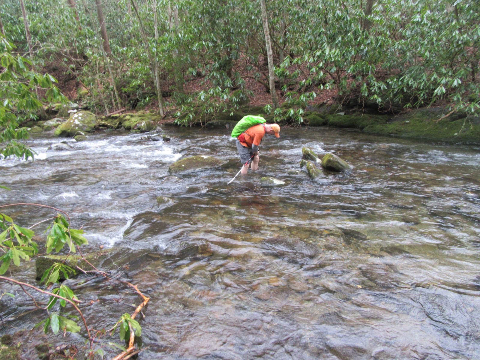 |
| Randy making his way across! |
A few steps from the water, we're returned to the Middle Prong Trail and begin our walk out back to Tremont wrapping up a long wonderful day.
TRAIL REVIEW
Middle Prong Trail - 4.1 miles
Lynn Camp Prong Trail - 3.7 miles
Miry Ridge Trail - 2.5 miles
Panther Creek Trail - 2.3 miles
Many cascades along Middle Creek
Old car and CCC camp
Indian Flats Falls
Campsite #26
Many water crossings along Panther Creek
Wanna hike the 900 without getting lost? Start by checking out the book Day Hiker's Guide To All The Trails In The Smoky Mountains by Elizabeth L. Etnier.
Hiking Trails of the Smokies or "The Little Brown Book" from the GSMA
Hiking Trails of The Great Smoky Mountains by Ken Wise
There is loads of information in the pages of GoSmokies.com.
No comments:
Post a Comment