Thunderhead

Hike #14 : March 21, 2014


Lead Cove Trail to Bote Mt. past Spence Field to Rocky Top and on to Thunderhead


13.1 miles
3.0 new miles
182.5 total overall miles
110.0 total miles of 800.8


I started this solo hike before sunrise. I put on the ol' headlamp and away I went. I started out from the Lead Cove Trailhead off of Laurel Creek Road. The first half mile is majorly littered with fallen trees. Not too difficult to get around though. The trail is a steady climb from the get-go. Lots of rock along the trail. Around 5 miles up the trail hits the AT and Spence Field. Always a beautiful sight. Lots of thru-hikers out and about.

From here, its the trail to Rocky Top. Since I've already covered this one, I'll spare you the details. I will say it was no easier this time than the last. However, if possible, the view was better than ever...


My last trip to Rocky Top was supposed to have continued on to Thunderhead but we were so tired we decided to call it a day. Not this time. Thing is, its only about half a mile further. An easy half a mile at that. 


Although Thunderhead has some really nice views, its overshadowed by Rocky Top. Its a shame too because it really is nice, just a little underwhelming after what you've already seen.


I made really good time heading back down the mountain. Trying to avoid the rocks while trying to move as fast as possible can be challenging but fun. Truly one of the best hikes I've ever been on. Saw some real signs of spring on the way out, too. Including this little guy catching some sun on the trail.


Well, that catches us up. From now on, my posts should be current. I hope you follow along! Happy trails!

TRAIL REVIEW

Lead Cove Trail - 1.8 miles (in and out)
Bote Mountain Trail - 1.2 miles (in and out)
Appalachian Trail - 1.85 miles out 1.85 miles back


1 shelter (Spence Field)


For more information about this hike and many more, visit Hiking in the Smokys


Brushy Mt.

Hike #13 : March 15, 2014


13.3 miles
5.9 new miles
169.4 total overall miles
107 total miles of 800.8


The first day of spring break and I'm spending it on the trail. Great day for hiking. After driving down the narrow gravel road to the trailhead, I'm ready to go. Got my new shoes on and I'm off! The hike begins on the Porters Creek Trail which, at least the mile I hike today, is basically a gravel road. Less than a mile in, I come to the old John Messer farmstead on the right. There's several buildings including an old barn dating back to 1875, a homestead and even a 2 seat outhouse. Fancy.


Just beyond here there's an old cemetery. Creepy as it may be, I really enjoy looking through the old tombstones. Someone had left flowers on every single one. Really nice.

After one mile, the trail forks. To the right, Porters Creek continues on towards campsite 31. The left merges onto Brushy Mountain Trail so right I go! 

As I continued, the trail climbs at a steady pace. A good pace. Ok, so somewhere around the 4th or 5th mile, I stop to apply chapstick when what appears to be a black chicken just wanders onto the trail ahead of me. I tried to get a picture but it scurried off like chickens do. Question is, was it some kind of wild chicken or is there even such a thing? Who knows. If you think you do, let me in on it. Really curious.

When I reach Trillium Gap, I turn right towards Brushy Mt., a right turn leads 3.6 miles up to Mt. LeConte. It's about a half mile to the top from here. Lots of rocks and mud for the feet here. The trail itself is remarkable...


The top really has some nice views right now. I'd assume that once everything is in bloom that the views may be more limited. After a nice lunch, I head back out. I really enjoyed this hike. No crowds. Just me and the mountains. Great day.

TRAIL REVIEW

Porters Creek Trail - 1.0 mile (in and out)
Brushy Mountain Trail - 4.9 miles (in and out)


For more information on this hike and many more, visit Hiking in the Smokys


Chimney Tops

Hike #12 : March 2, 2014


4 miles
2 new miles
142.8 total overall miles
101.1 total miles of 800.8


After a long hiatus from the trail, I'm going solo for my first hike in the park of the year. I'd hiked the Tops several years ago and recalled them to be a couple of really tough miles up. Boy, was I right. The first mile of the Chimney Tops Trail is uphill but nothing compared to the second mile. It's a 960 foot climb in a single mile. A real leg burner.

The Trails Forever program has been working on some extensive repair and upgrade work on this trail. I imagine this is one of the most popular trails in the park and all the overuse is bound to have ill effects over time.

After finally making it through that second mile, I come to the rock summit. Time to get my climb on!


Although this is not a huge climb, it could still be dangerous and then there's that whole fear of heights thing but its all good. Excellent views all around!


Heading back down, I was making really good time. Got back to the truck in no time. Shed my gear, threw my pack, sticks, pack and keys in the truck and locked the door. Wait... keys? So much for making good time. So, what's a man to do when he locks his dumbass self out of his truck on a mountain with zero cell service? Beg. Plead with every single person heading down the mountain to contact a ranger. What do these people do in my time of need? Promise to help of course. Empty promises, every one. Faith in humanity shaken. After over a hour, as fate would have it, there were several truckloads of park officials and press there to do a media piece on the repairs of the trail. They were more than happy to contact a ranger who arrived maybe 15 minutes later. I wish I could remember his name. He did a super job getting the door open and it wasn't easy. Thank you, park ranger dude!


For the record, not a single person contacted the ranger's office on my behalf like they promised. Don't be that person. If someone needs your help and you say you'll help, do it. I will mention that a nice couple from Georgia kept their word and called my wife and let her know what was happening. Always an adventure. 

TRAIL REVIEW

Chimney Tops Trail - 2.0 miles out 2.0 miles back


For more information on this hike and many more, visit Hiking in the Smokys


Andrews Bald

Hike #11 : September 7, 2013


3.5 miles
1.1 new miles
116.3 total overall miles
99.1 total miles of 800.8


This hike is a continuation of the Silers Bald hike in the last post. It seemed like a good idea at the time to add another 3.5 miles to an already 9.3 mile hike. We're not always smart men, Eddie and I. So we bypass Clingmans Dome by taking, you guessed it, the Clingmans Dome Bypass Trail and head straight down the mountain. This little trail is only .5 mile long and merges into the Forney Ridge Trail. This is a very tourist friendly hike. Wooden walkways, gravel and steps to try and make it family accessible.

This is our second attempt at Andrews Bald. The first was aborted due to massive fog but today its a clear blue sky. The panoramic views await! So we hike down and as we arrive, just before stepping out into the opening... fog. Honest to God. It was absolutely gorgeous until we got there. Andrew doesn't seem to care for us. The view...


No joke. We tried to wait it out but the walk up was looming. The fog would tease us occasionally and give us a peek but that was all we got. Guess we'll be going back for a third try someday.


The hike up was pretty strenuous but we did already have a good 10 miles in. All in all, it was another great day to be alive and on the trail!

TRAIL REVIEW

Forney Ridge Trail - 1.1 miles out 1.1 miles back


For more information on the hike and many more, visit Hiking in the Smokys


Silers Bald

Hike #10 : September 7, 2013


9.3 miles
4.8 new miles
125.6 total overall miles
98.0 total miles of 800.8


Me and Eddie (the guy trying his best to kill me) start this hike from the Clingmans Dome parking lot. Upon arriving, we are treated to a remarkable sunrise. The fog makes it look like we're above the clouds. This is why I love early starts. We take several pics and make our way to the trailhead.


This trail runs west along the Appalachian Trail. The unusual thing about it is that since we're starting at the highest point of the AT in the GSMNP, its all downhill. That's great. Its an out-and-back hike so that means coming back will be all uphill. That's no so great. Its a tremendous day for hiking. We quickly navigated our way down the trail. At around 3 miles, we come to the Double Spring Gap shelter where we meet several other hikers stirring from spending the night. Beyond that we reach Silers Bald which isn't much of a bald compared to others as its not maintained. There's also another shelter here, I assume its name is Silers Bald Shelter but I'm not sure about that. (Fact check: Yes, Silers Bald Shelter is the correct name.) Here we rest, snack and bullshit until its time to head back.


Heading back is much more strenuous and yet Eddie still convinces me its a good idea to bypass Clingmans Dome and hike down to Andrews Bald. Ok, so maybe it was my idea but let's just keep blaming Eddie. Anyway, I'll leave that to the next post... happy trails!

TRAIL REVIEW

Appalachian Trail - 4.2 miles out 4.2 miles back
Clingmans Dome Bypass - .5 mile

2 shelters (Double Spring Gap, Silers Bald)


For more information on this hike and many more, visit Hiking in the Smokys


Shuckstack

Hike #9 : August 3, 2013


11.7 miles
11.6 new miles
112.8 total overall miles
93.2 total miles of 800.8


Today we head to the North Carolina side of the Smokies to the Shuckstack Fire Tower. Since its a pretty long trip, Eddie's driving and I'm riding shotgun. After a quick stop at Hardees for some pre-hike grub (mistake) we head down US 129, also known as the Dragon, to Fontana. I've never been on the Dragon before so this is a new experience. And not a good one. There's over 300 sharp curves in under 11 miles on this nauseating road from hell. I'm not all that prone to car sickness but this is ridiculous. Eddie's doing like 120mph, zipping here, zagging there... I'm holding on for dear life and praying to God that the Frisco Breakfast Sandwich I had doesn't make encore appearance all over the from windshield.

The road finally straightens out and we arrive at the Fontana Dam and damn am I ready to get out of that damn Tahoe. After several long minutes in the public restroom to compose myself, the actual hike is set to begin.

We hike up the Appalachian Trail. About 2,100 feet up, in fact, in a mere 3 miles. A mile or so farther and after one last steep climb, we reach the fire tower. I was expecting another tower like I'd seen previously on Mt. Sterling and that's basically what I got. Only this one is definitely taller and, by default, definitely scarier. (After a fact check, it's a 60 foot tower just like Mount Sterling but it definately looked and felt taller) And like before, my paralyzing fear of heights is telling me there's no need to go up there. And, like before, Eddie is applying peer pressure like a schoolyard bully.


So, I did it. Shaking all the way. But the reward...


Wow.

I climb down and we have a drink before moving on. Eddie, by the way, did NOT go up the tower. He claimed he'd done it before. I've seen no proof of that. Draw your own conclusions. 

So on we go on up the AT until we come to the junction with the Twentymile Trail to the left and Lost Cove Trail to the right. We take a right and continue the loop. On this particular hike we both brought along our hammocks. We find a nice spot to camp, so we set up the hammocks. Actually, I'd never used a hammock before so Eddie set them both up and in we went. So here I am relaxing in a hammock in the Great Smoky Mountains...


...ahhhhh. But my rest is cut agonizingly short. BOOM! The hammock comes loose. I fall flat on my ass. If you recall, Eddie set up the hammocks. I'm now convinced he really is trying to kill me a little at a time. So, with an aching ass, I hike on out of there. Aside from a broken tailbone (not really) the hike out was pleasant enough. We came to the junction with the Lakeshore Trail after 2.7 miles. This section of the hike is mostly downward but seemingly very long. There's a few views of Fontana Lake as we go along but not as many as the name Lakeshore would indicate but then again, this is only a tiny part of a much longer Lakeshore Trail. Really was a great day of hiking. There were several old cars along the path, some intertwined with the trees. This one in particular had a cute message left by a previous hiker... 


My answer? My ass hurts.

TRAIL REVIEW

Appalachian Trail - 3.7 miles
Lost Cove Trail - 2.7 miles
Lakeshore Trail - 5.2 miles

1 campsite (91)


For more information on this hike and many more, visit Hiking in the Smokys


Charlies Bunion

Hike #8 : July 13, 2013


8.8 miles
4.4 new miles
101.1 total overall miles
81.6 total miles of 800.8


Eddie and I arrived just before daybreak at Newfound Gap to an abundant amount of fog. I'll be trying out a new piece of gear today. A cho-pat knee brace. If you've read some of my previous posts, you'll know why. Anyway, as we start up the Appalachian Trail, we're soon greeted by a spectacular sunrise. The fog quickly disappeared and the rays of sun showing through the trees was indescribably beautiful. I imagine between us we took dozens of pictures. I doubt we'll ever be blessed with another light display like that.


Around 3 miles in we came to the Icewater Spring shelter and hung out for a while. There actually is a pipe with a constant flow of water just a few steps down from the shelter. And, yes, it was ice cold. The next mile and a half was like walking through an enchanted forest and then the forest opens up to amazing views. 


Four and a half miles isn't that far to go considering the payoff here. Standing on Charlies Bunion watching the fog melt away as it rolled around the mountains is a true taste of freedom. Top of the world!


On the way back we stopped again at the shelter and had some nice conversation with other hikers as we counted the mice scurrying in and out of the shelter walls. We had planned on hiking out to The Jump Off but the fog had rolled back in taking with it any chance of a view. We'll get it next time.

When we were leaving, we decided to drive on up to Clingmans Dome and hike out to Andrews Bald but the fog wasn't having any of that. We couldn't see beyond the parking lot. Guess we'll get that one next time too! 

Oh, and the knee brace? Worked better than I could have dreamed. Now I have to buy another one for my other knee!

TRAIL REVIEW

Appalachian Trail - 4.4 miles out 4.4 miles back

1 shelter (Ice Water Spring)


For more information on this hike and many more, visit Hiking in the Smokys


Gregory Bald

Hike #7 : June 30, 2013

Gregory Ridge Trail to Gregory Bald


12 miles
6.2 new miles
92.3 total overall miles
77.2 total miles of 800.8


This was a solo hike from Forge Creek Rd. in Cades Cave to Gregory Bald. The trail is popular for its vivid display of azaleas and spectacular views. I started out on the Gregory Ridge Trail and begin a steady incline up the mountain. At about 3 miles in, the trail gets really rough. At 5 miles, I finally reached the Gregory Bald Trail. If I was thinking it would ease up a bit here (I did) then I was in for some disappointment as the trail continued a heavy incline. Then the payoff...


Unfortunately, I arrived slightly after the peak of the azaleas but there was still plenty to see. And plenty of azaleas!


The hike itself was, you guessed it, pretty much all uphill. Still, it was a beautiful day to be on the trail. After wandering around for while taking in all the beauty, I was ready to head back down the mountain when a deer stepped right out in front of me. It looked at me and went about its business as if I wasn't even there. Gotta love it. 


About a mile from the trailhead, my knee began feeling strange. I began to worry about whether it might go out again. With a few miles to go, I stepped over a small stream... and it went. Damn. 

I strongly suggest using hiking sticks on pretty much any hike. I can't tell you how many times they've saved my ass along the trails. On this hike, they became crutches allowing me to make that last few miles back.Gotta figure out what to do about the knees. Soon.

TRAIL REVIEW

Gregory Ridge Trail - 5.0 miles
Gregory Bald Trail - 1.2 miles


For more information on this hike and many more, visit Hiking in the Smokys


Rich Mountain

Hike #6 : June 15, 2013


8.5 miles
8.2 new miles
80.3 total overall miles
71.0 total miles of 800.8


This hike was originally supposed to be to Gregory Bald but Cades Cove was infested with bicyclist and it was going to take too long to reach that trailhead so we decided on this impromptu hike instead. The trailhead for Rich Mountain is just a few steps beyond the gate leading to Cades Cove Loop Road. We figured this to be an easy walk through the woods. In fact, its a quite strenuous trail.


The first mile and a half is a simple walk through the woods until we came to the John Oliver cabin in Cades Cove. From here things go up and get rocky. After about 3 miles we came to the Indian Grave Gap Trail and made a right to continue the loop. At 4.2 miles, the trail merges onto Rich Mountain Trail where the trail starts the level out a bit. There's not a lot of breathtaking views but its a very nice hike through the woods and there are occasional glances of Cades Cove.


At nearly 6 miles, we reached the junction with Scott Mountain Trail and Crooked Arm Ridge Trail. We make the right turn onto Crooked Arm Ridge to head down and complete the hike. 

Most notable about this hike was the baby bear that had evidently decided to rest beneath a pile of fallen branches and limbs. As we walked by unknowingly, we spooked it and it in turn spooked us. We stood silent for several minutes looking and listening for the little feller or perhaps its mother to no avail. 

Eddie made some new friends on this trail also. I suppose they have a lot in common. I thought I was going to have to leave him there. 


Yeah... that's poop. And that's it for Rich Mountain. Happy trails!

TRAIL REVIEW

Rich Mountain Loop Trail - 3.4 miles
Indian Grave Gap Trail - 2.6 mile
Crooked Arm Ridge Trail - 2.2 miles


For more information on this hike and many others, visit Hiking in the Smokys


Mt. Sterling

Hike #5 : May 25, 2013


Big Creek to Baxter Creek, Swallow Fork and back to Big Creek


16.6 miles
16.6 new miles
71.8 total overall miles
62.8 total miles of 800.8


This hike started out like any other. You know, with Eddie telling me how hard its not going to be. Huge lie.

We started out from the Big Creek area on the Baxter Creek Trail which after 4 miles or so miles of vertical climbing, I affectionately renamed the Bastard Creek trail. At about 5 miles up we stopped for a quick break. That means I had to stop before my heart beat its way clear out of my chest. As we started to move on, the first step I took, my knee completely gave out on my right leg. I could hardly put any weight on it at all. The pain was bad. Very.

At this point, I'm scared. We're 5 miles up a rigorous mountain and just over a mile from the top. I had to decide to try and go on or try and go back. Neither option seemed particularly possible at the time. But I decided to try and go on. It was horrible. Painful. I kept wondering if this would be my last hike.

Pressing on and trying my damnedest to ignore the pain, we made it to the top. I virtually collapsed.


At the top, there's an old fire tower. I should mention I'm afraid of heights. Big time. So here I am with a knee that is on fire with pain and about a million wooden half-rotten steps to the top of this 60 foot rusty tower of death. Sounds fun, right? Eddie, being his supportive self, convinces me I didn't just go through hell to get here only to not go all the way. Damn him. He's right.


I did it. It hurt. It was terrifying. It was worth it. What a view!


We traveled on to Swallow Fork Trail and around Big Creek Trail to complete the loop. I'm not sure if Eddie realizes how close I was to not making it. Turns out that my Merrell shoes with the air cushioned heals had collapsed and I was walking with slightly turned ankles. Not sure if that's what caused it but it couldn't have helped. Not the best hike and certainly not a great day. I can't blame that on the trail but my injury blurred the overall experience. I'll go back to Mt. Sterling someday but I have no plans of hiking Bastard Creek anytime in the near future. 

TRAIL REVIEW

Bastard... Uh, Baxter Creek Trail - 6.1 miles
Mount Sterling Ridge Trail - 1.4 miles
Swallow Fork Trail - 4.0 miles
Big Creek Trail - 5.1 miles

3 campsites (36, 37, 38)


For more information on this hike and many more, visit Hiking in the Smokys


Ramsey Cascades

Hike #4 : April 27, 2013


8 miles
4 new miles
55.2 total overall miles
46.2 total miles of 800.8


On this day, Eddie and I set out in the pouring rain from the Ramsey Cascades Trailhead to hike to see water. More specifficly, cascades. This was a nice little hike and much easier compared to the last few we'd done. The rain really didn't distract too much from that. A couple of miles in, we came to these huge tulip trees. I'm 6'2" and these trees make me look tiny. Pretty awesome.


A few more miles and we were there. As we approached the cascades, I think the tempreture dropped about 1,000 degrees. Then we took off our backpacks and it dropped another 1,000 degrees so we didn't hang around very long. Still, it was an amazing site to see.


By the time we made it back to the trailhead we were soaked. I guess a raincoat can only take so much. Still, a very good and enjoyable hike. I'll definately have to go back in drier weather someday.

On a side note, when leaving, if you drive across 321 to Hills Creek Road, there's a really cool covered bridge. So now you know.


Hike on...

TRAIL REVIEW

Ramsey Cascades Trail - 4.0 miles out 4.0 miles back


For more information on this hike and many more, visit Hiking in the Smokys


Rocky Top

Hike #3 : April 13, 2013


Cades Cove Picnic Area to Anthony Creek, Bote Mt. to the AT and Spence Field to Rocky Top, back out to Russell Field along the AT and back to Anthony Creek


15.6 miles
11.9 new miles
47.2 total overall miles
42.2 total miles of 800.8


Wish that I was on ol' Rocky Top...

This one was supposed to start at sunrise but was slightly preempted by the gate to the picnic area being locked. Fortunately, a ranger came by and unlocked it before we (Eddie, Mike and I) had to resort to plan B. Still don't know what plan B would have been but there's no way it would have been good.

This is definitely a hardcore hike. Its all up hill and its called Rocky Top for a reason. Its extremely rocky and rough on the feet. This is also a horse friendly trail which means mud. Deep, black, slippery and inescapable mud. We start the trail from the Cades Cove picnic area on Anthony Creek Trail. It starts out as an incline up a gravel road before heading into the forest. At 3.5 miles, we reach the junction with Bote Mountain Trail. After a right turn, we continue up to the Appalachian Trail for 1.7 miles. When we reached Spence Field, the sky was blue and the view spectacular. It was here I met my first thru-hiker, Jeff. A nice guy with a big ol' backpack. Hope he made it to Maine.


After leaving Spence Field, the trail seemed to get easier. Downhill in fact. Don't be fooled. This is only a trick! After about half a mile breezing downhill all la-ti-da and all, the earth seemingly falls off its axis and you begin what seems like a 90° incline. Mike and I are traveling at a pace of three feet and rest while Eddie finally gets fed up with our inabilities and speeds past us like a Lamborghini passing a dump truck. Have I mentioned my deep hatred for Eddie? Nevermind. Alas, we did eventually get there and it was so worth it. The view from good ol' Rocky Top is hard to beat. Many say its the best view in the park and its hard to argue that when you're there. 


As we made our way out, Eddie somehow convinced us we wanted to go the long way and stop at every shelter along the way as we looped around the Russell Field Trail. He's evil like that. Evil. Anyway, we did meet some interesting people and had a great day. As we hit Anthony Creek we really picked up the pace. I had gone on and on about the ice cream shop at the Cades Cove Campground store. Let me just say right here on the interweb in front of God and everybody that the ice cream in Cades Cove is the best in the universe. This fact is not up for debate. I wanted my ice cream and that motivated the crap right out of me. In hindsight, we may have went a little too fast for Mike. It was only the 2nd hike he'd ever been on.

Sadly, this hike ended on a sad note. The campground store wasn't open. No ice cream.

No ice cream...


Oh, well. Here's a picture of me and a really cool, albeit dead, tree.


Until next time. 

TRAIL REVIEW

Anthony Creek Trail - 3.5 miles 
Bote Mountain Trail - 1.7 miles
Appalachian Trail - .3 mile
Appalachian Trail - 2.9 miles
Russell Field Trail - 3.5 miles
Anthony Creek Trail - 1.6 miles

2 campsites (9, 10) and 2 shelters (Spence Field and Russell Field)


For more information on this hike and many more, visit Hiking in the Smokys


Mt. LeConte

Hike #2 : March 29, 2013


Rainbow Falls to LeConte and down Bull Head


13.0 miles
13.0 new miles
31.6 total overall miles
30.3 total miles of 800.8


March 29th, 2013.

Eddie Wright, Mike Clark and myself finally begin our journey to LeConte. Great day for hiking. A bit overcast and a slight chance of rain. We start our hike at the Rainbow Falls Trailhead. It's a steady climb from the start. I've heard this is a very rocky trail but the snow has smoothed things out nicely for us. By the time we reach Rainbow Falls at about 3 miles in, we're starving and stop for a bite and to admire the falls. Lots of ice. Time to put on the cleats!


From hear the trail is a continuous and unrelenting climb mile after mile. The last couple of miles up to LeConte proved to be the most difficult I can recall ever having hiked. I honestly wasn't sure I was going to make it. By this point there's around a foot of snow on the ground and its really starting to snow pretty hard. I can't even recall how many times I thought to myself how big a mistake this is. At about 5 feet from the summit I pause trying to gain my breath and not die. Poor impatient Eddie kept saying "It's right there! Let's go! It's right there! You can see it!" Lord help me how I wanted to kill that man. Mike was silent but no doubt sharing in my desire to do bodily harm. But we made it. Stumbled into one of the buildings, shed ourselves of our gear, sat down and died. Then we bought t-shirts.

We made our way over to the lodge for a incredibly flavorsome cup or two of hot chocolate. Possibly the best ever. I think Mike and Eddie had coffee. By now the snow is intense. Unfortunately we were running a little short on time and headed out to get to hiking down via the Bull Head Trail.


Along the way down the snow tapered off into a light to moderate rain and the trail went from packed snow to mud rather quickly. At least we're on a steady downhill path now. Then it happened. Dagnabbit! Blowout! Mike's shoe totally blew out. Oh, fuuuuu... dge. Only he didn't say fudge. You get it. Anyway, he had to put his cleats back on along with some duct tape if I recall correctly and continue on. We were soaked by the time we made it back but all in all, one of the best hikes ever.

TRAIL REVIEW

Rainbow Falls Trail - 6.7 miles
Bullhead Trail - 5.9 miles
Old Sugarlands Trail - .4 mile

1 shelter (LeConte)


For more information about this hike and many more, visit Hiking in the Smokys


How It Begins... Mt. Cammerer

Hike #1 : March 16, 2013


18.3 miles
17.3 new miles
18.3 total overall miles 
17.3 total miles of 800.8


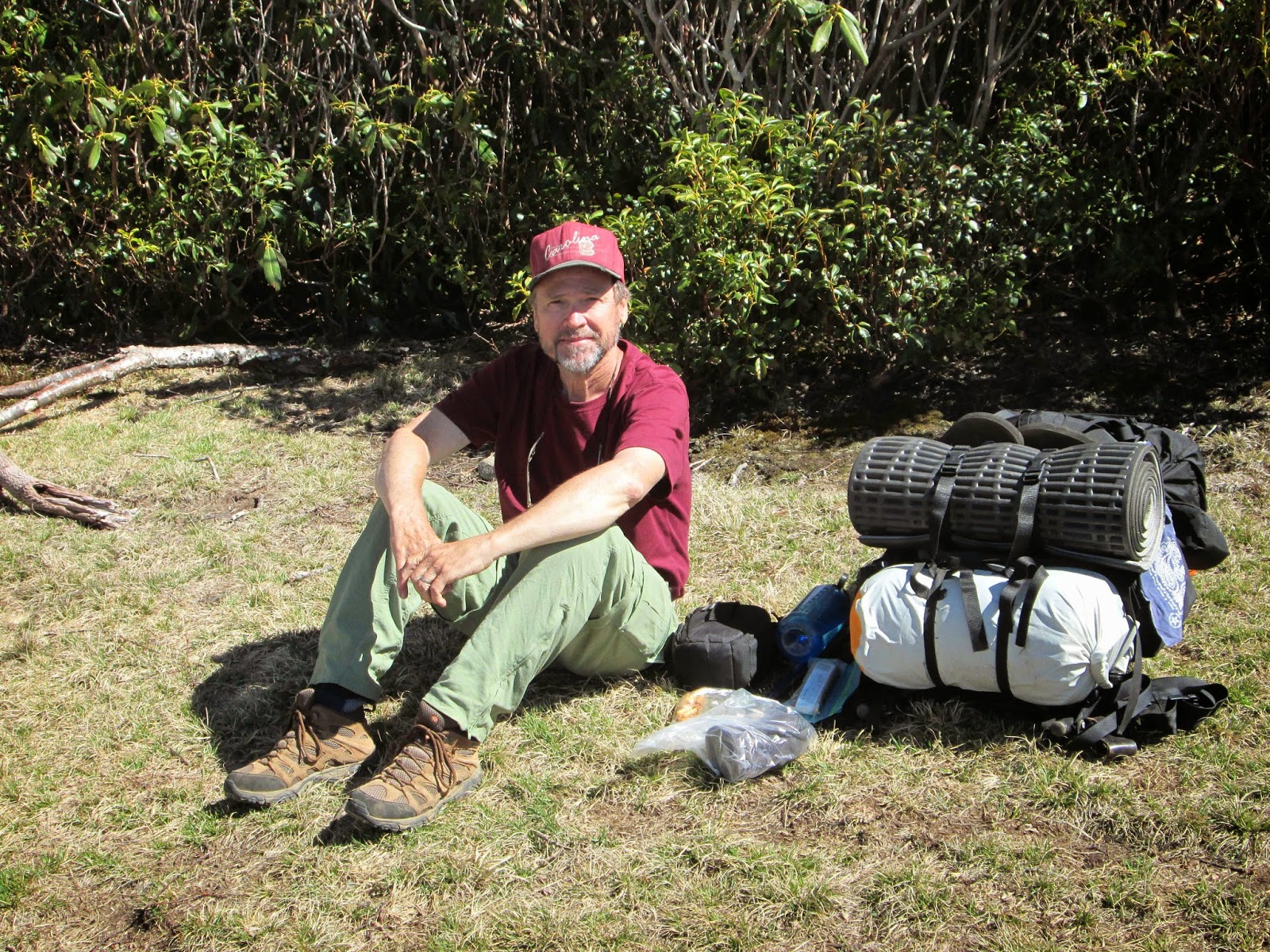
Hello, I'm Keith (aka Hikertrash) and this is my journey.

My goal is to hike every trail in The Great Smoky Mountains and join the elusive 900 club. My story started last year, so my first several entries here will be backtracking. Here we go..

It started early in 2013. After a long absence from the trail, a few friends and myself decided to hike Mt. LeConte the week the lodge opened in late March. So after a few starter hikes (Angel Falls Overlook in Big South Fork and House Mountain in East Knox County), I had the grand delusion that I was a seasoned hiker ready to climb the highest mountains.

On March 16th, I set forth from the Cosby Campground on the 
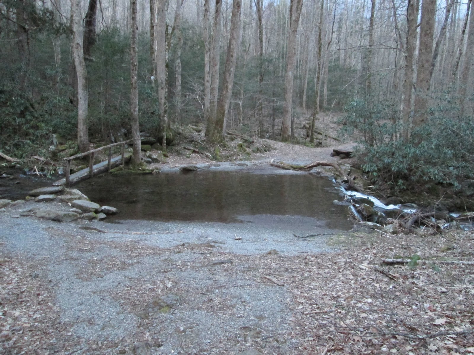
Low Gap Trailhead to conquer Mt. Cammerer. This was to be a simple 12 mile round trip up and down the mountain. The first 1/2 mile was pleasant enough. Nice and flat with a gentle cool breeze blowing over my weighted shoulders.


The nice and flat didn't last. The next 3 miles leading to the Appalachian Trail were brutal. My friend and often hiking partner, Eddie, had told me it leveled out after the junction. I should point out now that Eddie is an expert hiker and a huge liar but we'll get into that more later. At the junction, this was the first time I stepped foot on the glorious and mystical Appalachian Trail. It truly was a spiritual moment for me. After briefly basking in the glow of being on sacred ground, I continued up the trail. The next 2 and a half miles were not exactly leveled out as Eddie had claimed. They were slightly less brutal, yes, but still up. Way up. Hench the whole Eddie's a liar thing.

So, after what seemed like weeks, I reached the spur of the half mile 
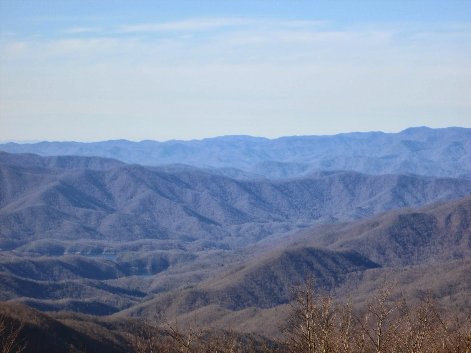
Mount Cammerer Trail and then... there it was. Its hard to describe something so beautiful with mere words. The lookout tower would be a sight to see if it were anywhere in the world. Here, at over 4,900 feet, it is a breathtaking beauty to behold.


And then there's the incredible 360° views...


Now, the story should end with me hiking back down the way I came up as planned. Should. However, somewhere in the excitement and emotional ineptitude of my tired mind, I decided to take this hike to the next level and make it a loop hike instead of an up-and-back. I had ever so briefly looked at the loop trail on the map days prior to the hike. The very same map I did not feel compelled to bring with me on the actual hike. Anyway, as I recalled, the loop was only a mile or so longer and I could surely handle that. After all, its all down hill from here.

After passing a small cemetery, I begin the hike down the Lower Mount Cammerer Trail. The best way to describe this trail is to say its the wilderness version of Groundhog Day. You go around the mountain, down a hill, cross a stream, up a hill and repeat. Over and over and over. By this point I was able to judge my mileage by the time on my watch. At some point, I came to realize I had positively gone more than the 7 or so miles I was sure I needed to to reach the campground and my truck. I must have missed a turn? A switchback? Something. Don't panic. I backtracked to the last trail marker I passed about half a mile back. It was a small lookout trail or something whose name I can't recall. I decided to call for help since I fortunately had a signal on my phone. I called the Cosby ranger's station. No answer. Don't panic. Hmmm... it's getting dark. Ok, panic a little. I'm running very low on water. I have no source of light. No map and no clue where the hell I'm at. I called Eddie. No answer. Panic. He called back. I explained everything in detail as he searched his map to see where I was. You know that little off trail I mentioned? It's not on the map. Panic. Eddie, who was driving home from his own day of hiking, turns around to come find me. His advice was keep going down the mountain and if it gets too dark to just wait. He'd find me or get help. I keep going. Wife calls and asks where I'm at and if I'm ok. Yes, I'm ok but I don't have any idea where I'm at and I'm out of water. Panic times two. Then just minutes later... a trail marker. Cosby Campground .5 miles. I was never lost. It wasn't 6 or 7 miles like I thought it was. It was around 10. I rush to the truck on legs that have reached their limits and speed from the campground where I had no phone signal and called Eddie to let him know I was out. Called the wife and did the same. Lesson learned.

Not ideal but I did learn that I could physically hike over 16 miles without dying. I'd caught the hiking bug.

I also bought a GPS.

TRAIL REVIEW

Low Gap Trail - 2.9 miles
Appalachian Trail - 2.1 miles
Mount Cammerer Trail - .6 mile out .6 mile back
Appalachian Trail - 2.3 miles
Lower Mount Cammerer Trail - 7.4 miles
Cosby Campground Trails - 2 miles

1 campsite (35)
Cosby Campground


For more information about this trail and many more, visit Hiking In The Smokys