Hike #46 : August 29, 2015
14.4 miles
2.7 new miles
576.9 total overall miles
387.2 total miles of 800.8576.9 total overall miles
The Mt. Sterling Trail has been on the old hiking radar for a long time. So when Randy was ready for his first fire tower experience, it was time to go!
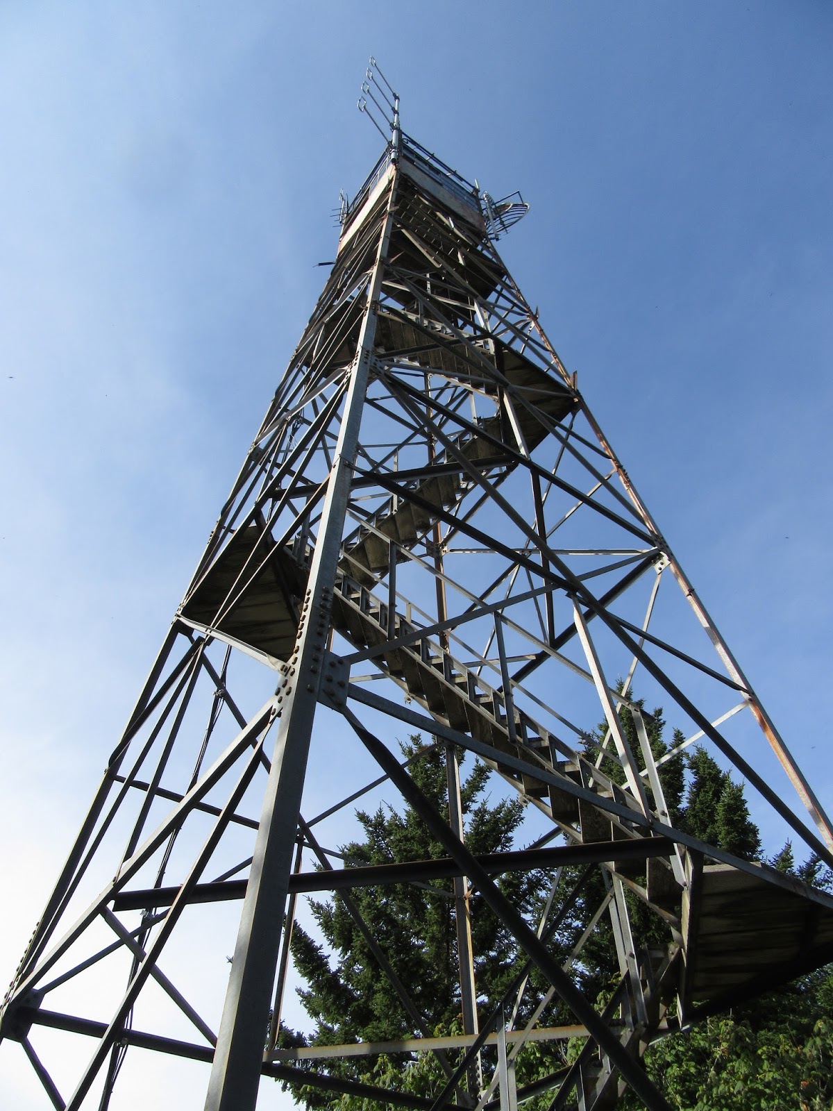 |
| Mt. Sterling Fire Tower |
Eddie, Randy and myself decided to make the hike into a car drop so that we could hike up to the tower and and down Big Creek stopping by Mouse Creek Falls and the Midnight Hole. So after leaving a car at the Big Creek Trailhead, we made our way along the seven miles of graveled Mt. Sterling Road (which turns into Old Cataloochee Turnpike after a while) to the trailhead on the right.
After reaching the trailhead, the hike begins as a moderate climb. Before we can even get into a groove, I suddenly hear the bloodcurdling horrific sound of Randy yelling "BEAR!!!!!!!!!!!!!!" to the top of his lungs. Before I could even get turned around, the mama bear had flew down a tree like a firefighter on fireman's pole, no doubt scared half to death by Randy's banshee scream. The rather large cub, however, lingered behind most likely too scared to know what to do. Eddie and I snapped a few pictures while Randy inched forward on the trail. I'm pretty sure that was his way of saying 'let's get the hell outta here before we die a bloody horrific death by bear mauling!' Lol! So, we moved on after the cub finally scurried down the tree and off towards its mommy. Pretty cool way to start the day!
 |
| As Randy would say... its a BEAR!!!!!!!!!!!!!!!! |
Soon after the not-so-deadly-after-all bear encounter, we come to the trail junction with the Long Bunk Trail to the left. This is the only real level part of the trail. I've heard that Mt. Sterling Trail is one of the hardest in the park and the next mile and a half definitely test one's hiking abilities. It's straight up.
I was surprised by all the blooming flowers along the way.


After a mile and a half or so, there's a wonderful view to the left of the trail where the power lines cut through the forest.
 |
| The view from the Mt. Sterling Trail |
From here, the trail continues up hill but at a much more moderate rate and before we know it, we've reached the end of the Mt. Sterling Trail as we come to the Baxter Creek Trail. That first mile and a half was rough but I wouldn't call this the hardest trail in the park. Not at all. A right turn onto Baxter will lead to the fire tower just past campsite #38.
The tower rises 60ft. and allows unrestricted 360° views as far as the eyes can see.
 |
| First view of the tower |
 |
| What a view! |
 |
| Campsite #38 in the shadow of the tower |
Now, as I've said before, I do not like nor do I handle heights particularly well. And by not particularly well, I mean they scare the bejeezus right out of me. My fear of heights, however, may pale in comparison to Randy's. It's kinda nice not being the least experienced hiker after all these hikes with Eddie the superhiker. Surely after already climbing this tower and the similar tower at Shuckstack, I'd be just fine and show Randy how it's done. Yeah... not so much. For some strange reason the first two flights of stairs are terrorizing! Forcing myself on, it gets easier the further up I go. Still, when I climb into the top, I'm shaking like a leaf in a hurricane. It was several minutes before I could gather myself enough to take pictures.
As I was hollering down words of encouragement to Randy, thinking he wasn't going to make it, when he suddenly appeared at the door! He'd defied logic and made the climb! He didn't hang around long but he made it! Even Eddie, after a little peer pressure, made the climb.
 |
| In the tower... |
 |
| Look who made it! |
Several minutes and dozens of pics later we climb down, had a snack and moved on back down Baxter Creek Trail to the junction with Swallow Fork and Pretty Hollow Gap. From here we head down Swallow Fork to Big Creek which I've previously blogged about here a few years ago.
I will mention that since I was pretty badly injured the last time I hiked down Big Creek, I passed up the opportunity to stop by Mouse Creek Falls and the Midnight Hole even though they are both just off the trail. Not this time.
 |
| Mouse Creek Falls |
 |
| Midnight Hole |
 |
| A nice double waterfall just past the Midnight Hole |
We had an absolute wonderful time on this hike. Sometimes there just isn't anything better than being out on the trail with good friends. Aside from the steep beginning and the distance covered, it was a mostly not too bad a hike (I refuse to call any trail easy) with almost all of it downhill after the fire tower.
Miles covered and fears conquered (at least until the next time!)
Happy trails!
TRAIL REVIEW
Mt. Sterling Trail - 1.8 miles
Baxter Creek Trail - 2 miles
Swallow Fork Trail - 4.0 miles
Big Creek Trail - 5.1 miles
Campsite #38
Mt. Sterling fire tower
Mouse Creek Falls
Midnight Hole
Wanna hike the 900 without getting lost? Start by checking out the book Day Hiker's Guide To All The Trails In The Smoky Mountains by Elizabeth L. Etnier.
Hiking Trails of the Smokies or "The Little Brown Book" from the GSMA
Hiking Trails of The Great Smoky Mountains by Ken Wise
There is loads of information in the pages of GoSmokies.com.
No comments:
Post a Comment