Hike #30 : December 14, 2014
10 miles
9.8 new miles
385.8 total overall miles
277.2 total miles of 800.8385.8 total overall miles
The day started with a beautiful drive along the Foothills Parkway at sunrise.

The hike began from the Abrams Creek Campground off Happy Valley Road on Abrams Creek Campground Road in Tallassee. Parking is just past the ranger station. From here the walk begins at the gate leading to the campground. This is just an easy walk along a smooth gravel road straight through the campground to another gate that is the trailhead to Cooper Road Trail.
Cooper Road Trail is just that, a wide mostly smooth road trail. The trail rises gently as it passes the junction with Little Bottoms Trail that leads to Abrams Falls at 1.3 miles. Around 2 miles, the trail begins to climb more steadily and starts to feel more like a hike than a walk in the woods until nearing the 3 mile mark at the junction with the Gold Mine Trail.

Turning left onto the Gold Mine Trail, the trail begins to get rocky. Big ankle twisters. Goldmine is a rather short .8 mile hike to the park's boundary but don't be fooled, its not the easiest of hikes. Its all uphill until you reach the end at the park boundary and just feet from the Top of the World community. There's a barn just past the boundary on private property. The good news is its all downhill back to the junction.
Once back at the junction, a left turn puts you back on Cooper Road Trail for .4 mile to the junction with Cane Creek Trail. Cane Creek goes to the right and Cooper Road switches back to the right. There's also an unmarked trail that veers off just right of the trail sign. My friend Eddie had told me that it was a well worn trail to a gravesite so I definitely wanted to check it out.
The trail to the grave is steep and narrow in a few places and was very hard to see in others. The fallen leaves made it difficult at times to follow the trail. But taking my time I had minimal trouble finding it. At the end of the trail is a lone tombstone of the twin sons of John and Nola Lail. For more info and some pics, click here.
After returning back to the trail junction, a right turn takes you along the Cane Creek Trail. The trail soon begins a steady downhill climb until leveling out after half a mile or so. From here its a mostly downgrade walk on a mostly, sometimes rocky and often muddy, smooth surface. At 1.3 miles you'll come to the Buchanan Cemetery on the right and up a slight hill.

Continuing on, there are several rock hops as you near the park boundary and plenty of opportunities to get the feet wet. I didn't pass up many of these opportunities much to my dismay. Cold wet feet. I did learn, however, my new hiking shoes dry out quickly. After 2.1 miles, you'll come to the park boundary where you'll find No Trespassing signs. Its obvious the trail goes on presumably to meet up with Ace Gap Trail and Beard Cane Trail. Might have to manway that someday.

The walk back up Cane Creek is slightly upgrade until about half a mile from the junction where the climb starts. At the junction, you'll continue back onto Cooper Road Trail passing a couple of boulders placed on the trail. From here, the trail is steadily climbing.With 9 miles already hiked, the climb feels pretty strenuous. Still, another beautiful trail.
After a long 1.8 miles, you'll come to the Hatcher Mountain Trail junction. The Hatcher Mountain Trail was closed for two years after the devastating EF-4 tornado in the spring of 2011. Though the trail was cleared, the devastation is still very much everywhere you look along this trail. The trail is overgrown and many trees are piled up on the sides while others still stand snapped off and weakened or dead causing many downed trees along the trail. I counted no less than twenty in about a mile and a half. Still, considering the scope of the damage, its amazing the trail is even there anymore.

At 2.6 miles, Hatcher Mountain junctions with Little Bottoms Trail which leads back to Cooper Road Trail and back to the parking lot. I've already blogged about this portion of the hike here.
Overall, I really enjoyed this hike. It's long and difficult in places and the tornado damage is downright depressing... but what a beautiful day to be blessed with ability to hike. I love these mountains.
Today's trail signs...

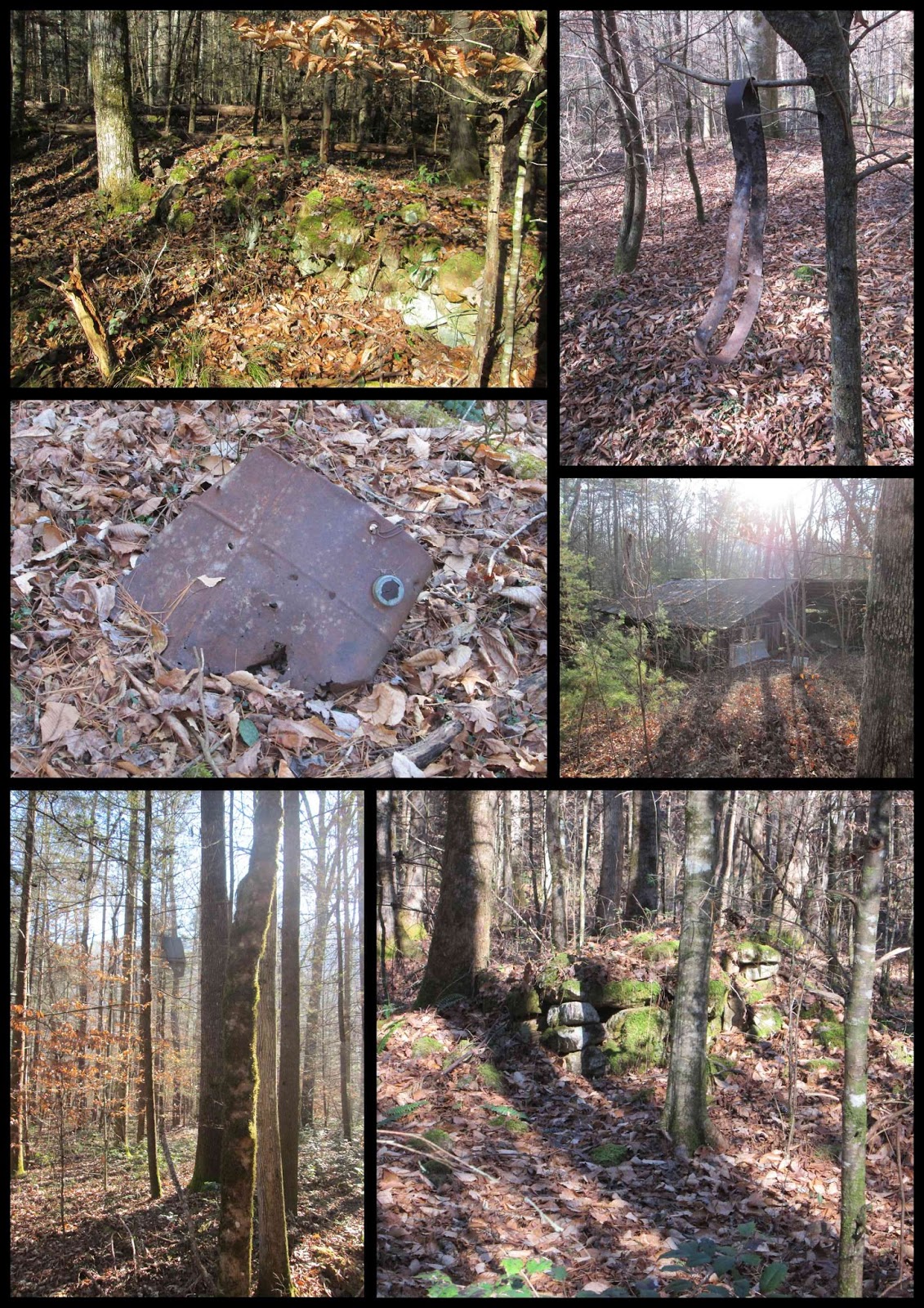
Signs of life along the way...
TRAIL REVIEW
Cooper Road Trail - .9 mile
Gold Mine Trail - .8 mile one way (out & back)
Cooper Road Trail - .4 mile
Unmarked trail to Lail Cemetery - .3 mile one way (out & back)
Cain Creek Trail - 2.1 miles one way (out & back)
Cooper Road Trail - 1.8 miles
Hatcher Mountain Trail - 2.6 miles
Little Bottoms Trail - 2.3 miles
Cooper Road Trail - .9 mile
Buchanan Cemetery

Wanna hike the 900 without getting lost? Start by checking out the book Day Hiker's Guide To All The Trails In The Smoky Mountains by Elizabeth L. Etnier.
For more pictures of my hikes, check out the Smoky Mountain Hikertrash facebook page.
No comments:
Post a Comment