Hike #36 : May 9, 2015
3.5 miles
10.2 new miles
461.4 total overall miles
329.5 total miles of 800.8461.4 total overall miles
The day started at the Old Sugarlands trailhead just before reaching the Sugarlands Visitor Center on Hwy. 441. There's a small parking area for maybe four cars to the left.
I chose this hike because its a bit easier than many that I've been doing of late and since I've been having some foot pain for the past week or so it seemed smart not to go too big. And I've always wanted to see the famous rock house. The weather was really nice starting out. I'd encountered a few sprinkles of rain coming into Servierville but the forecast was clear so no worries, right?
The trail is mostly a smooth and level gravel bed with only a few hills along the way as I started out. About a mile and a half in, there was a gentle rain beginning to fall. No big deal and, actually, it felt pretty good. Soon, however, the rain became steady.
At 1.7 miles in, I came to an unmarked trail (well, actually its a well defined roadbed) marked with a small three sided stone structure heading off to the right leading moderately uphill. This is where I expect to find the Sugarlands Cemetery and the rock house so I take a right onto the trail/road.
Just a few steps up this roadbed I must have tripped the wire to release monsoon season in the Smokies. Suddenly it was raining so hard I could hardly hold my eyes open for fear of a contact lens being flooded from my eye. It was intense. I tried hiking through it but it was relentless so I sought shelter under the first rock overhang I came to. About twenty minutes later the sun was out and the rain stopped. I'd spend the remainder of the day trying to dry out.
 |
| Just a little water on the trail... |
From here, I continued on up slightly to a fork in the trail. I go to the right along a stone wall until reaching a nice cascade. My camera was still a little fogged over and wet from the rain so I decided to retrieve my phone from my pack for today's picture taking. As I started to remove my pack, it was as if someone kicked my feet out from under me and I fell stone dead on the rocks. Worst fall I've ever had hiking. I'm amazed I didn't break an arm or something. Too bad no one was there to see that one!

After several pics, I head on to find the Sugarlands Cemetery. It was also at this point I came to realize I wasn't properly prepared for this hike. I wasn't sure which way to go so I picked a trail and went. Although it was a nice trail, eventually it appeared to be leading back to the highway so I turned back and chose another trail that luckily led to the cemetery.

After many, many pics and a while of looking at and reading the old stones in the cemetery, I was off to find the stone house I've heard so much about. Unfortunately, I wasn't very well prepared for that either and wandered aimlessly off-trail for miles. Yeah, it was still pretty damn fun just exploring but I'd like to have found the rock house. Guess I have a good excuse to go back. This area will definitely be on my list of fall/winter hikes this year. There's a lot off exploring to be had here.
Ultimately, with no luck finding the rock house or even the old CCC clock tower, I decided if I was going to hike the rest of the Old Sugarland Trail, I needed to get to it. So I headed back down the old roadbed and turned right back onto the Old Sugarlands Trail. From here the trail climbs rather steeply for the next few miles. This part of the trail is kinda hard and offers little reward as far as sights to see so it would be used mainly by mile markers looking to hike every trail or those on horseback coming from various horse trails in the area.
 |
| My original plan was to loop back via the Grassy Branch Horse Trail. One look at that muddy mess and plans changed fast. Yuck! |
After reaching the junction with the Bullhead Trail, its only 6.4 miles on up to LeConte but since I'm not crazy (at least not that crazy!), I turn around to head back out the way I came. It's 3.5 mile from the parking lot to this spot but with all the off-trail meandering, I'm already well over six miles.
On the way down I'm still wondering where that dang blasted rock house is and why I never even saw the old CCC clock tower. Turns out I missed the clock tower most likely because it was already raining steadily when I came through earlier. Fortunately, I didn't miss it this time and I'm soon off-trail wandering again.

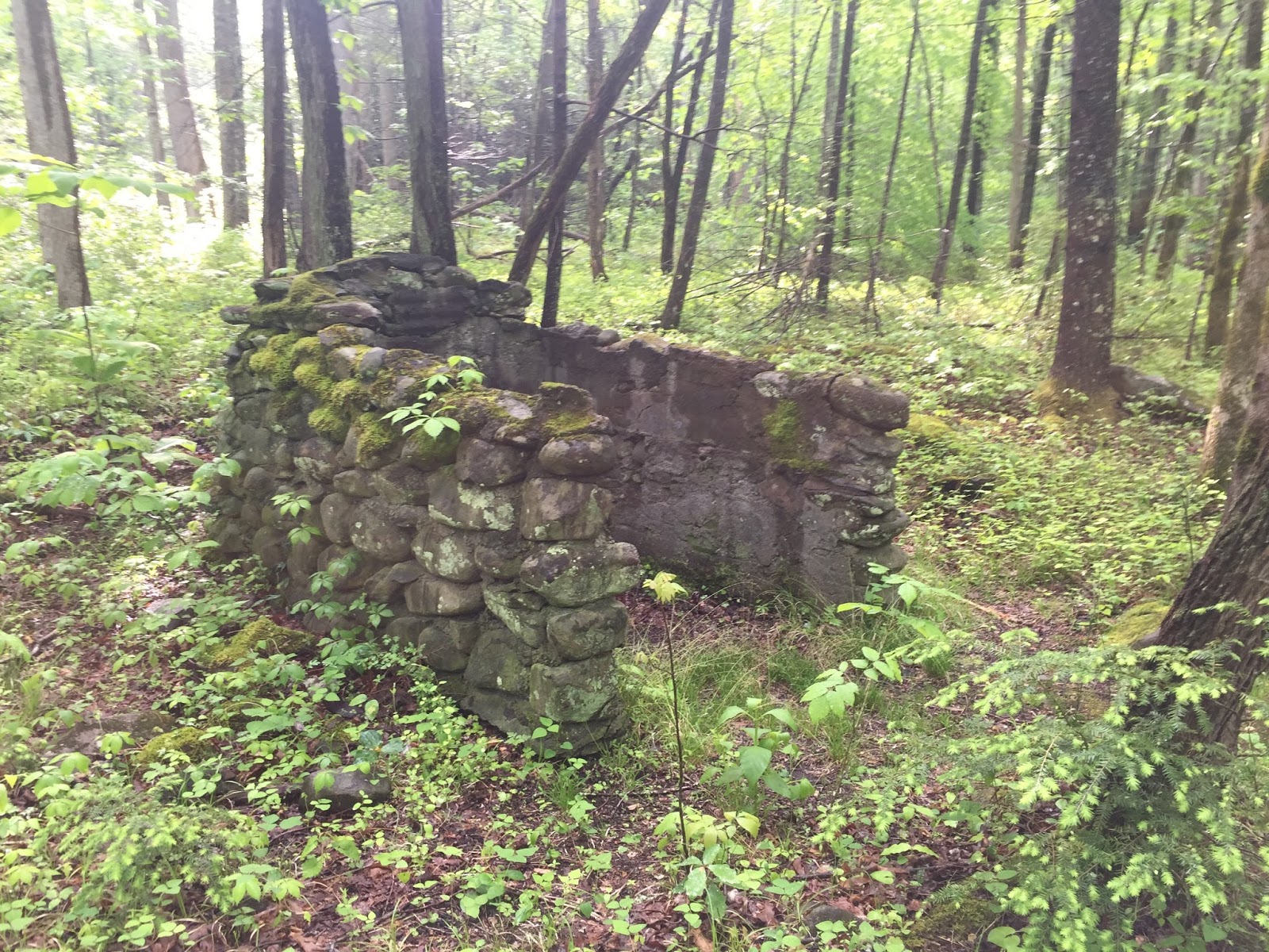
I follow a faint trail from the clock tower to what looks like an old stone flowerbed or possibly where a flag once flew. The trail led to another trail junction of sorts. Left, right and up the bank. I go up the bank first and see stone - the rock house?! - nope. But two impressive large chimneys still standing in all their glory. Magnificent!


From here I start wandering all through the area finding all sorts of cool and strange items...

After getting a little carried away with all the off-trail wandering, I thought I'd better move on before I ran into a snake or who knows what. I can't wait to come back here and I have no idea why it took me so long to do this hike in the first place. Absolutely loved it!
I had great day on and off this trail despite the fact that my foot hurt all day, I never completely dried out from all the rain and my arm took a heck of a blow bouncing off that rock when I fell and then there's the whole not finding what I was looking for thing. But on the positive side, it was all part of a wonderful adventure with many discoveries, a beautiful cemetery and it was also the first hike in about two years where I didn't wear a knee brace. I call that a good day. A good day indeed.
EDIT:
A few weeks after this hike, I enlisted the help of Mr. Eddie Wright along with Randy Hullinger and made a quick trip back up this trail. Eddie, having been to the rock house before, was our guide. Although his confidence was a little shaky at times, we made it!


TRAIL REVIEW
Old Sugarlands Trail - 3.5 miles each way (7 miles round trip)
Various off trail ventures - 5.1 miles
Sugarlands Cemetery
Old CCC camp, etc.
Wanna hike the 900 without getting lost? Start by checking out the book Day Hiker's Guide To All The Trails In The Smoky Mountains by Elizabeth L. Etnier.
Hiking Trails of the Smokies or "The Little Brown Book" from the GSMA
Hiking Trails of The Great Smoky Mountains by Ken Wise
There is loads of information in the pages of GoSmokies.com.
Where the path veers. The left fork took you to the cementary. THe right fork, you follow it for a mile or two and come to a stream. Cross the stream adn on top of little hill is the rock house. It is close to highway
ReplyDeleteWhere the path veers. The left fork took you to the cementary. THe right fork, you follow it for a mile or two and come to a stream. Cross the stream adn on top of little hill is the rock house. It is close to highway
ReplyDelete