Huskey Gap, Little River, Rough Creek, Sugarland Mountain

Hike #31 : December 30, 2014


16.2 miles
12.8 new miles
402 total overall miles
290.0 total miles of 800.8


The weather wasn't exactly cooperating when I hit the trail on this one. So I donned my rain jacket and put on my gore-tex shoes and headed on to the Huskey Gap Trailhead just off Newfound Gap Road about two miles south of Sugarlands Visitor Center.

Huskey Gap Trail is an immediate climb up from the moment you step off the road. Even with a heavy mist in the air, the trail is pretty cool. The grape vines are of all sizes and as plentiful as any trail I've been on. I'm a big fan of the vines, they look awesome tangling around the trees and spiraling over the trail. Add the eeriness of the fog and mist and its quite a show.


The trail continues its 1,300 foot climb until reaching the junction with the Sugarland Mountain Trail at the 2 mile mark. From here the trail levels out for about a half mile before heading downhill towards campground #21 at about 3.7 miles in. From here its uphill for about a quarter mile then down about .2 to the junction with the Little River Trail.

The Little River Trail is a wonderfully pleasant trail. I've previously hiked the upper 2.4 miles of this trail last month and loved it. After turning left onto the trail leaving Huskey Gap, the walk is a slight uphill path passing the junction with Goshen Prong Trail at 1.3 miles and on to campsite #24 at the 2 mile mark. Just before coming to the campsite, the trail seaming ends dropping off into the not so Little River. Since it has been an especially wet week leading up to this hike, I assume the water is higher than normal. I had to wander upstream for a while before finding a safe place to rock hop. There were so many rock hops along this hike, I couldn't possibly recall them all. A very wet day. Continuing less than a quarter mile farther is the junction to Rough Creek Trail to the left.

Rough Creek Trail starts off  with a more inclined climb but still moderate enough. Shortly, the trail once again disappears into the Little River. Walking up and down the bank offered no safe rock hop that I could find. The water was fast and rather deep for wading. There was a large tree that had fallen over the river that looked possible. Without giving it too much thought, I stepped up and took a few steps. Next thing I know, I'm on the other side wondering what the hell I was thinking doing that. Fear of heights and falling be damned on this trip!

A few of the difficult passings including the fallen tree.
Rough Creek continued along the water with many rock hops and began getting steeper as it went. About 1.2 miles in, I learned the reason it's called ROUGH Creek. The trail becomes steep. The trail also becomes gone in several places. Actually washed away down the side of the mountain which happens to be a very steep drop off. I imagine a fall here could be very dangerous. Adding to the overall nastiness are the many, many fallen trees across the trail. I literally had to crawl under some and over others. I was a muddy mess! In hindsight, it was a pretty cool adventure but I doubt I'd want to do it again!

After the last 1.6 mile hike up out of the trail hell of Rough Creek, it was a near religious experience making it to the junction with the Sugarland Mountain Trail.

The first mile of Sugarland Mountain was more uphill than I was anticipating but it was up and down. I stopped for lunch at rock wall with a natural built-in seat before continuing down the last 3 miles. Soon after, the weather took a serious turn and the temperature dropped dramatically. The trees were suddenly iced over and freezing mist was battering my face. Gloves on. After a few miles, the mist died off and the temperature rose again. This is where I got to see a bobcat walk leisurely across the trail in front of me about twenty yards ahead. Wish I could have got a picture but it was gone in a flash. Then the fog rolled in. Big time.

The last 2.5 miles of Sugarland Mountain were a welcomed downhill stroll all the way to the junction with Huskey Gap.

The fog was very dense going back down the 2 miles of Huskey Gap where the hike started. The trail was also a massive pile of mud by this time. The fog added an unexpected element to hiking, an almost eerie feeling. Perhaps I've seen too many late night horror films. Either way, I really enjoyed it.


The trail signs...


TRAIL REVIEW

Huskey Gap Trail - 4.1 miles
Little River Trail - 1.8 miles
Rough Creek Trail - 2.8 miles
Sugarland Mountain Trail - 4.1 miles
Huskey Gap Trail - 2 miles

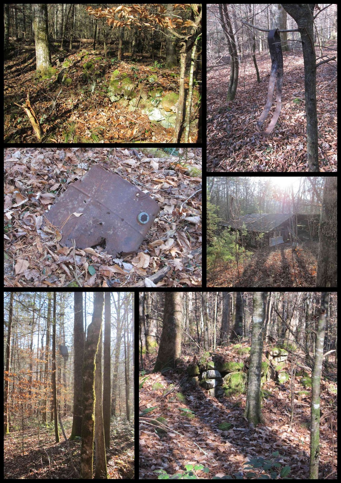
Campsites #21 and #24

*There's also a small unusual and unmarked campsite with bear cables and all about a mile or so from Huskey Gap on the Sugarland Mountain Trail. I assume it's no longer in use as it doesn't appear on the trail map.


Wanna hike the 900 without getting lost? Start by checking out the book Day Hiker's Guide To All The Trails In The Smoky Mountains by Elizabeth L. Etnier.


Cooper Road Trail, Gold Mine Trail, Cane Creek Trail, Hatcher Mountain Trail

Hike #30 : December 14, 2014


10 miles
9.8 new miles
385.8 total overall miles
277.2 total miles of 800.8


The day started with a beautiful drive along the Foothills Parkway at sunrise.


The hike began from the Abrams Creek Campground off Happy Valley Road on Abrams Creek Campground Road in Tallassee. Parking is just past the ranger station. From here the walk begins at the gate leading to the campground. This is just an easy walk along a smooth gravel road straight through the campground to another gate that is the trailhead to Cooper Road Trail.

Cooper Road Trail is just that, a wide mostly smooth road trail. The trail rises gently as it passes the junction with Little Bottoms Trail that leads to Abrams Falls at 1.3 miles. Around 2 miles, the trail begins to climb more steadily and starts to feel more like a hike than a walk in the woods until nearing the 3 mile mark at the junction with the Gold Mine Trail.


Turning left onto the Gold Mine Trail, the trail begins to get rocky. Big ankle twisters. Goldmine is a rather short .8 mile hike to the park's boundary but don't be fooled, its not the easiest of hikes. Its all uphill until you reach the end at the park boundary and just feet from the Top of the World community. There's a barn just past the boundary on private property. The good news is its all downhill back to the junction.

Once back at the junction, a left turn puts you back on Cooper Road Trail for .4 mile to the junction with Cane Creek Trail. Cane Creek goes to the right and Cooper Road switches back to the right. There's also an unmarked trail that veers off just right of the trail sign. My friend Eddie had told me that it was a well worn trail to a gravesite so I definitely wanted to check it out.

The trail to the grave is steep and narrow in a few places and was very hard to see in others. The fallen leaves made it difficult at times to follow the trail. But taking my time I had minimal trouble finding it. At the end of the trail is a lone tombstone of the twin sons of John and Nola Lail. For more info and some pics, click here.

After returning back to the trail junction, a right turn takes you along the Cane Creek Trail. The trail soon begins a steady downhill climb until leveling out after half a mile or so. From here its a mostly downgrade walk on a mostly, sometimes rocky and often muddy, smooth surface. At 1.3 miles you'll come to the Buchanan Cemetery on the right and up a slight hill.


Continuing on, there are several rock hops as you near the park boundary and plenty of opportunities to get the feet wet. I didn't pass up many of these opportunities much to my dismay. Cold wet feet. I did learn, however, my new hiking shoes dry out quickly. After 2.1 miles, you'll come to the park boundary where you'll find No Trespassing signs. Its obvious the trail goes on presumably to meet up with Ace Gap Trail and Beard Cane Trail. Might have to manway that someday.


The walk back up Cane Creek is slightly upgrade until about half a mile from the junction where the climb starts. At the junction, you'll continue back onto Cooper Road Trail passing a couple of boulders placed on the trail. From here, the trail is steadily climbing.With 9 miles already hiked, the climb feels pretty strenuous. Still, another beautiful trail.

After a long 1.8 miles, you'll come to the Hatcher Mountain Trail junction. The Hatcher Mountain Trail was closed for two years after the devastating EF-4 tornado in the spring of 2011. Though the trail was cleared, the devastation is still very much everywhere you look along this trail. The trail is overgrown and many trees are piled up on the sides while others still stand snapped off and weakened or dead causing many downed trees along the trail. I counted no less than twenty in about a mile and a half. Still, considering the scope of the damage, its amazing the trail is even there anymore.  


At 2.6 miles, Hatcher Mountain junctions with Little Bottoms Trail which leads back to Cooper Road Trail and back to the parking lot. I've already blogged about this portion of the hike here.

Overall, I really enjoyed this hike. It's long and difficult in places and the tornado damage is downright depressing... but what a beautiful day to be blessed with ability to hike. I love these mountains. 

Today's trail signs...


Signs of life along the way...


TRAIL REVIEW

Cooper Road Trail - .9 mile
Gold Mine Trail - .8 mile one way (out & back)
Cooper Road Trail - .4 mile
Unmarked trail to Lail Cemetery - .3 mile one way (out & back)
Cain Creek Trail - 2.1 miles one way (out & back)
Cooper Road Trail - 1.8 miles
Hatcher Mountain Trail - 2.6 miles
Little Bottoms Trail - 2.3 miles
Cooper Road Trail - .9 mile

Lail Cemetery
Buchanan Cemetery


Wanna hike the 900 without getting lost? Start by checking out the book Day Hiker's Guide To All The Trails In The Smoky Mountains by Elizabeth L. Etnier.


For more pictures of my hikes, check out the Smoky Mountain Hikertrash facebook page.