Old Settlers Trail (Part 2)

Hike #32, Part 2 : January 24, 2015


300 MILES!!!

15 miles
9.5 new miles
422 total overall miles
307.0 total miles of 800.8


For our second trip to the Old Settlers Trail, Eddie and I will again be doing a car drop. We met at Greenbrier Cove and left a car at the small parking area just across the bridge heading toward the Ramsey Cascade trailhead. We then drove along 321 to the Texas Creek Manway across from Texas Lane. Although our first trip to OST started with an three mile bushwhack, we decided it best to forgo that craziness and use an actual trail this time.

The Texas Creek Manway runs directly off 321 between two rock walls. This is not an official trail nor is it mapped. The trail itself is mostly flat and in pretty good shape, although there are many downed trees along the way but they are easy enough to go around.


Texas Creek Manway

Upon reaching the OST, the trail heads uphill along the creek. For a while here, we are hiking along the same part of the trail we did a few weeks ago but soon we find ourselves on new ground. That new ground was quickly covered in snow. A surprising amount of snow in fact.


One of the first of many chimneys along the Old Settlers Trail

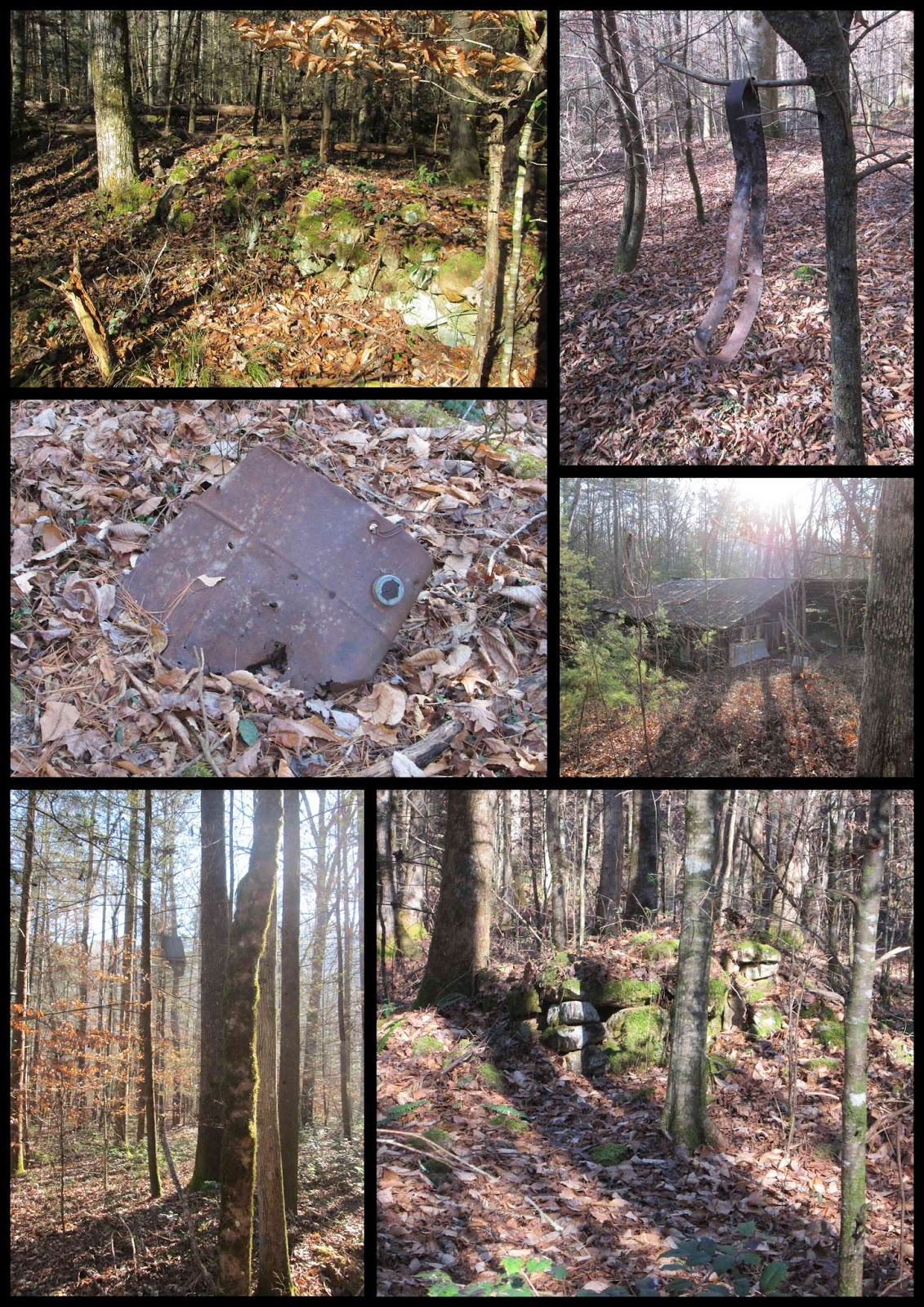
The snow soon went away as we began our way down into lower elevations over the few miles. There are so many wonderful sights along this trail. Rock walls, chimneys, old pieces of stoves and cookware... it's amazing.


This chimney is the Norm Ramsey homestead.
(I know that thanks to Mike Maples)

After 1.8 miles, the manway to Noisy Creek heads to the right. We walked a ways along Noisy Creek and enjoyed the cascading water and what looked like a few past homesteads with rock piles along the bank before heading back up to the OST. About a quarter of a mile farther along, the trail takes a steep climb as we pass Ramsey Creek. Shortly, we come to a large stone wall to the left with a smaller wall to the right.


This is the Homer Reagan homestead.
(Again, I know that thanks to Mike Maples)

A short walk along the wall and we came to a magnificent chimney.


At 4.1 miles, we reached campsite 33, which is also the site of an old homestead itself complete with chimney and more rock piles. On up at about 4.8 miles, there's another unmarked trail to the right that is a wide manway leading to 321. As the trail continues, there's still much to see.


As we made our way along the trail, nearing our next stop at the Frazier Cemetery, we came across something I'd never imagined seeing, a deer. A very dead and mostly eaten deer. We had no idea what killed it but judging by the scat just feet away, we were pretty sure a bear had just enjoyed a hearty lunch.


Bear brunch?


Just beyond the gore, we came to our destination. Another unmarked trail leading right. We take the side trail and it soon splits. To the right the trail heads to 321 and to the left is the trail leading to the Frazier Cemetery.

After returning to the OST, we hit the 6 mile mark when we come to Soak Ash Creek where just before the trail crosses the creek, there are side trail to the left and the right. We took the trail to the left that leads to Green Cemetery. Its just a short walk that leads to a really steep climb but worth it if you're into the whole cemetery thing. The trail to the right may lead to the Doc Green Cemetery but we didn't have time to find out. Maybe another time.

From here, its more uphill climb. About 2 miles of climb until the trail levels out. The OST is such a remarkable trail with its incredible diversity and history but it is not an easy walk through the woods. It can be very strenuous at times and although it is certainly possible to hike it in its entirety in a single day, I would never recommend it. There's too much to see.


With about .3 of a mile to go before reaching the parking lot in Greebrier Cove, we take another off trail walk. This one was a little more hidden but with the leaves down, there's a visible path. I missed it but fortunately Eddie didn't. So we made our way to the Parton Cemetery and back. From here we make our return to the parking lot. 

As we left, we made a quick stop at the Grapeyard Ridge Trailhead and made a half mile round trip to the old Friendship Church site and the Friendship Cemetery.
At the end of the day, I was physically spent as the sun was setting on one of our greatest hikes ever. As an added bonus, I think Eddie has caught the fever to explore more of these off trail adventures. 

I highly recommend that anyone looking to do any adventuring in the Greenbrier area to check out Mike Maples' blog on GoSmokies.com. He is the definitive source for Old Greenbrier and is just a really nice man in general.


A last little collection of some of the old signs of lives past...


TRAIL REVIEW

Old Settlers Trail - 10.7 miles
Various off trail ventures - 6.3 miles

Campsite #33

Frazier, Green and Parton Cemeteries

Numerous homesteads, chimneys, ect.


Wanna hike the 900 without getting lost? Start by checking out the book Day Hiker's Guide To All The Trails In The Smoky Mountains by Elizabeth L. Etnier.

Hiking Trails of the Smokies or "The Little Brown Book" from the GSMA


There is loads of information in the pages of GoSmokies.com.

Old Settlers Trail (Part 1)

Hike #32, Part 1 : January 17, 2015


13.5 miles
7.5 new miles
402 total overall miles
297.5 total miles of 800.8


Today, Eddie and I met at the Maddron Bald Trailhead to do a car drop hike of the eastern half of the Old Settlers Trail. So after leaving a car at Maddron, we head down 321 to find a spot near Texas Creek to park and begin our hike. And then things got... interesting.

There is no pull-off at what we believed to be the Texas Creek manway, only a few businesses across the road. Unsure whether it would be okay to park there, we decided to cruise on down the road where we came to a pull off. I'm not sure why there is a pull-off here but there certainly isn't a trail of any kind, manway or not. So what to do? Ah, let's just throw on our backpacks and head into the woods. We have a couple of maps and my trusty GPS. What could possibly go wrong? (Yes, I actually said that as we headed in...)

Things start off just fine as we make our way along the... uh, whatever you'd call it. The trail-less woods. Stepping over and through the trees and brush, we head northeast toward the OST. Soon, this bushwhack turns sharply uphill and along a steep ridge testing our ankles and balance. This is rough and untamed terrain. I wouldn't really recommend this to anybody but it was extremely challenging and fun in its own way. After a few falls, actually one was more of a four or five foot slide, the climb continues up, through, around and over every sort of hazard the forest could throw at us.

As we continued our steep hike through incredibly thick underbrush and trees, I closely monitored the GPS as we got closer and closer to the trail. Then something strange happened as we reached the trail according to the GPS... there was NO trail. Up until this moment it was all fun and games but suddenly not knowing exactly where the trail was or how far we had to go, things grew a bit somber. There was really nothing to do but stay our course. And we did. Word to the wise: if you happen to have a Garmin GPS and use MapSource to plan your hike, IT IS WRONG! Not a little off, not even a mile off. Completely wrong to the point of being useless. This is the first (and hopefully last) time I've had this happen after over a year's worth of hiking with it. And of course it happened the very first time we decided to go completely off trail. Nice.

Soon we heard water. It had to be Texas Creek. At least we now had some idea of where we were. As I crossed the creek, I came up the bank and there it was. The trail. Thank God! After checking with Eddie's topo map, we figured out where we were and finally began our hike. After nearly 3 miles of off trail madness.

The rewards of hiking the OST were quick and plentiful.


This is a very historically rich trail. It's also a good trail with little in the way of rocks and roots. In the next couple of miles, there is so much to see and so many pictures to take that I can't possibly go through them all. This is easily a favorite trail for me as I love imagining the way things were all those years ago.


Many, many chimneys

There's many of these stone structures along the trail. These were made by the families of the original settlers as a way of marking the now gone homesites

After about a mile, we came across some other hikers. I immediately recognised one as Mr. Mike Maples. Smoky Mountain Guru. We had a very interesting conversation and even got some directions to some cool places we wanted to check out along the trail. Mike's a great guy and I was really honored to meet him. Look him up on facebook or read some of his wonderful stories at Go Smokies.


Me and Mr. Mike Maples

Unfortunately, we didn't follow those directions very well and ended up off trail walking in circles for a while. Not lost... just turned around. The stone walls along this trail are numerous but none equaled to the one shortly before coming to Webb Creek. This wall is between five and six feet tall and seems to run the distance of a football field. Behind it and off trail there are many piles of rock and another wall almost as impressive. The work and time that must have gone into these walls is staggering!


Eddie standing next to the massive stone wall.

At the two mile mark, we come to Webb Creek and the junction with the side trail to the Tyson-McCarter Barn and homesite which is clearly marked. A quick 600ft. walk leads to the barn.


Tyson McCarter Barn

This where we had lunch and lamented the craziness of our first three miles of the day. Returning back to the trail, we are greeted with an uphill climb and the possibility of losing daylight. The trail climbs about 700 feet in just over a mile with more rock walls and piles and piles of rocks everywhere before dropping down for a mile or so and coming to another side trail, marked by a pile of rocks, leading to Maddron Cemetery to the right. From here, its back up for about .3 of a mile to the Maddron Bald junction. Maddron Bald is a wide and smooth downhill gravel roadbed. After a half mile, the Willis Baxter Cabin appears to the left. Its a well maintained home built in 1889. The trail goes another .7 of a mile downhill finishing out the hike.


Willis Baxter Cabin


Signs of life along the way...


TRAIL REVIEW

Off Trail - 3 miles
Old Settlers Trail - 6.3 miles
More off trail - 2.7 miles


Wanna hike the 900 without getting lost? Start by checking out the book Day Hiker's Guide To All The Trails In The Smoky Mountains by Elizabeth L. Etnier.

Hiking Trails of the Smokies or "The Little Brown Book" from the GSMA


Huskey Gap, Little River, Rough Creek, Sugarland Mountain

Hike #31 : December 30, 2014


16.2 miles
12.8 new miles
402 total overall miles
290.0 total miles of 800.8


The weather wasn't exactly cooperating when I hit the trail on this one. So I donned my rain jacket and put on my gore-tex shoes and headed on to the Huskey Gap Trailhead just off Newfound Gap Road about two miles south of Sugarlands Visitor Center.

Huskey Gap Trail is an immediate climb up from the moment you step off the road. Even with a heavy mist in the air, the trail is pretty cool. The grape vines are of all sizes and as plentiful as any trail I've been on. I'm a big fan of the vines, they look awesome tangling around the trees and spiraling over the trail. Add the eeriness of the fog and mist and its quite a show.


The trail continues its 1,300 foot climb until reaching the junction with the Sugarland Mountain Trail at the 2 mile mark. From here the trail levels out for about a half mile before heading downhill towards campground #21 at about 3.7 miles in. From here its uphill for about a quarter mile then down about .2 to the junction with the Little River Trail.

The Little River Trail is a wonderfully pleasant trail. I've previously hiked the upper 2.4 miles of this trail last month and loved it. After turning left onto the trail leaving Huskey Gap, the walk is a slight uphill path passing the junction with Goshen Prong Trail at 1.3 miles and on to campsite #24 at the 2 mile mark. Just before coming to the campsite, the trail seaming ends dropping off into the not so Little River. Since it has been an especially wet week leading up to this hike, I assume the water is higher than normal. I had to wander upstream for a while before finding a safe place to rock hop. There were so many rock hops along this hike, I couldn't possibly recall them all. A very wet day. Continuing less than a quarter mile farther is the junction to Rough Creek Trail to the left.

Rough Creek Trail starts off  with a more inclined climb but still moderate enough. Shortly, the trail once again disappears into the Little River. Walking up and down the bank offered no safe rock hop that I could find. The water was fast and rather deep for wading. There was a large tree that had fallen over the river that looked possible. Without giving it too much thought, I stepped up and took a few steps. Next thing I know, I'm on the other side wondering what the hell I was thinking doing that. Fear of heights and falling be damned on this trip!

A few of the difficult passings including the fallen tree.
Rough Creek continued along the water with many rock hops and began getting steeper as it went. About 1.2 miles in, I learned the reason it's called ROUGH Creek. The trail becomes steep. The trail also becomes gone in several places. Actually washed away down the side of the mountain which happens to be a very steep drop off. I imagine a fall here could be very dangerous. Adding to the overall nastiness are the many, many fallen trees across the trail. I literally had to crawl under some and over others. I was a muddy mess! In hindsight, it was a pretty cool adventure but I doubt I'd want to do it again!

After the last 1.6 mile hike up out of the trail hell of Rough Creek, it was a near religious experience making it to the junction with the Sugarland Mountain Trail.

The first mile of Sugarland Mountain was more uphill than I was anticipating but it was up and down. I stopped for lunch at rock wall with a natural built-in seat before continuing down the last 3 miles. Soon after, the weather took a serious turn and the temperature dropped dramatically. The trees were suddenly iced over and freezing mist was battering my face. Gloves on. After a few miles, the mist died off and the temperature rose again. This is where I got to see a bobcat walk leisurely across the trail in front of me about twenty yards ahead. Wish I could have got a picture but it was gone in a flash. Then the fog rolled in. Big time.

The last 2.5 miles of Sugarland Mountain were a welcomed downhill stroll all the way to the junction with Huskey Gap.

The fog was very dense going back down the 2 miles of Huskey Gap where the hike started. The trail was also a massive pile of mud by this time. The fog added an unexpected element to hiking, an almost eerie feeling. Perhaps I've seen too many late night horror films. Either way, I really enjoyed it.


The trail signs...


TRAIL REVIEW

Huskey Gap Trail - 4.1 miles
Little River Trail - 1.8 miles
Rough Creek Trail - 2.8 miles
Sugarland Mountain Trail - 4.1 miles
Huskey Gap Trail - 2 miles

Campsites #21 and #24

*There's also a small unusual and unmarked campsite with bear cables and all about a mile or so from Huskey Gap on the Sugarland Mountain Trail. I assume it's no longer in use as it doesn't appear on the trail map.


Wanna hike the 900 without getting lost? Start by checking out the book Day Hiker's Guide To All The Trails In The Smoky Mountains by Elizabeth L. Etnier.


Cooper Road Trail, Gold Mine Trail, Cane Creek Trail, Hatcher Mountain Trail

Hike #30 : December 14, 2014


10 miles
9.8 new miles
385.8 total overall miles
277.2 total miles of 800.8


The day started with a beautiful drive along the Foothills Parkway at sunrise.


The hike began from the Abrams Creek Campground off Happy Valley Road on Abrams Creek Campground Road in Tallassee. Parking is just past the ranger station. From here the walk begins at the gate leading to the campground. This is just an easy walk along a smooth gravel road straight through the campground to another gate that is the trailhead to Cooper Road Trail.

Cooper Road Trail is just that, a wide mostly smooth road trail. The trail rises gently as it passes the junction with Little Bottoms Trail that leads to Abrams Falls at 1.3 miles. Around 2 miles, the trail begins to climb more steadily and starts to feel more like a hike than a walk in the woods until nearing the 3 mile mark at the junction with the Gold Mine Trail.


Turning left onto the Gold Mine Trail, the trail begins to get rocky. Big ankle twisters. Goldmine is a rather short .8 mile hike to the park's boundary but don't be fooled, its not the easiest of hikes. Its all uphill until you reach the end at the park boundary and just feet from the Top of the World community. There's a barn just past the boundary on private property. The good news is its all downhill back to the junction.

Once back at the junction, a left turn puts you back on Cooper Road Trail for .4 mile to the junction with Cane Creek Trail. Cane Creek goes to the right and Cooper Road switches back to the right. There's also an unmarked trail that veers off just right of the trail sign. My friend Eddie had told me that it was a well worn trail to a gravesite so I definitely wanted to check it out.

The trail to the grave is steep and narrow in a few places and was very hard to see in others. The fallen leaves made it difficult at times to follow the trail. But taking my time I had minimal trouble finding it. At the end of the trail is a lone tombstone of the twin sons of John and Nola Lail. For more info and some pics, click here.

After returning back to the trail junction, a right turn takes you along the Cane Creek Trail. The trail soon begins a steady downhill climb until leveling out after half a mile or so. From here its a mostly downgrade walk on a mostly, sometimes rocky and often muddy, smooth surface. At 1.3 miles you'll come to the Buchanan Cemetery on the right and up a slight hill.


Continuing on, there are several rock hops as you near the park boundary and plenty of opportunities to get the feet wet. I didn't pass up many of these opportunities much to my dismay. Cold wet feet. I did learn, however, my new hiking shoes dry out quickly. After 2.1 miles, you'll come to the park boundary where you'll find No Trespassing signs. Its obvious the trail goes on presumably to meet up with Ace Gap Trail and Beard Cane Trail. Might have to manway that someday.


The walk back up Cane Creek is slightly upgrade until about half a mile from the junction where the climb starts. At the junction, you'll continue back onto Cooper Road Trail passing a couple of boulders placed on the trail. From here, the trail is steadily climbing.With 9 miles already hiked, the climb feels pretty strenuous. Still, another beautiful trail.

After a long 1.8 miles, you'll come to the Hatcher Mountain Trail junction. The Hatcher Mountain Trail was closed for two years after the devastating EF-4 tornado in the spring of 2011. Though the trail was cleared, the devastation is still very much everywhere you look along this trail. The trail is overgrown and many trees are piled up on the sides while others still stand snapped off and weakened or dead causing many downed trees along the trail. I counted no less than twenty in about a mile and a half. Still, considering the scope of the damage, its amazing the trail is even there anymore.  


At 2.6 miles, Hatcher Mountain junctions with Little Bottoms Trail which leads back to Cooper Road Trail and back to the parking lot. I've already blogged about this portion of the hike here.

Overall, I really enjoyed this hike. It's long and difficult in places and the tornado damage is downright depressing... but what a beautiful day to be blessed with ability to hike. I love these mountains. 

Today's trail signs...


Signs of life along the way...


TRAIL REVIEW

Cooper Road Trail - .9 mile
Gold Mine Trail - .8 mile one way (out & back)
Cooper Road Trail - .4 mile
Unmarked trail to Lail Cemetery - .3 mile one way (out & back)
Cain Creek Trail - 2.1 miles one way (out & back)
Cooper Road Trail - 1.8 miles
Hatcher Mountain Trail - 2.6 miles
Little Bottoms Trail - 2.3 miles
Cooper Road Trail - .9 mile

Lail Cemetery
Buchanan Cemetery


Wanna hike the 900 without getting lost? Start by checking out the book Day Hiker's Guide To All The Trails In The Smoky Mountains by Elizabeth L. Etnier.


For more pictures of my hikes, check out the Smoky Mountain Hikertrash facebook page.

Metcalf Bottoms to Little Brier Gap

Hike #29 : November 26, 2014


2.5 miles
2.2 new miles
375.8 total overall miles
267.6 total miles of 800.8


After hiking the Cucumber Loop, I decided to go on to the Metcalf Bottoms Trail and hike up to the Little Greenbrier Trail to knock off a few more miles.

The trail starts just across the bridge in the Metcalf Bottoms Picnic area. The pull off is only big enough for about three cars but you could always park in the picnic area and walk across the bridge.

The trail is, like all the others, beautiful. Its a mostly gentle rolling trail with just a few roots popping out of the leaves.


At .6 mile, you'll come to the Little Greenbrier School and cemetery. The cemetery is severely eroded but still very touching. The school is a simple one room schoolhouse built in 1882.


I can't help but get a Little House on the Prairie vibe inside the school. I love the feeling these places stir up. 


After checking out the school and cemetery, its time to hit the Little Brier Gap trail. It starts at the top of the hill above the cemetery and climbs moderately for 1.1 miles to the junction with the Walker Sisters side trail. Here, a right turn leads to the cabin and home site. The trail sign says .1 mile but I'm guessing its a bit more than that. Regardless, its worth the walk.


The Walker Sisters' place is very well maintained and really takes the mind back in time. There's also a springhouse and corn crib on the property and all are in remarkable shape. The original cabin dates back to the 1840s and has been added on to since. 

After leaving the cabin, its back to the trail junction. Here, you can return back to the schoolhouse and Metcalf Bottoms by taking a left. But, again, I'll be going right instead to finish off Little Brier Trail by hiking on up to the Little Greenbrier Trail. The section of the trail is the steepest but is only a little less than a half mile. After reaching the junction, its time to turn around and head the 2.5 miles back to Metcalf Bottoms and call it a day.

TRAIL REVIEW

Metcalf Bottoms Trail - 1 mile
Little Brier Gap Trail - 1.5 miles

Little Greenbrier School
Little Greenbrier Cemetery
Walker Sisters' Place


Wanna hike the 900 without getting lost? Start by checking out the book Day Hiker's Guide To All The Trails In The Smoky Mountains by Elizabeth L. Etnier.


For more pictures of my hikes, check out the Smoky Mountain Hikertrash facebook page.

Cucumber Loop

Hike #28 : November 26, 2014


5.4 miles
5.2 new miles
373.3 total overall miles
265.4 total miles of 800.8


After a month long hiatus due to shin splints, general soreness, a bout with a probable sinus infection and working three weekends in a row, I finally made my way back to the mountains. Since my last hike into the bowels of hell, my legs have been excruciating. Shin splints suck. But after a month off the trails and several evening walks, I should be fine, right? Well...

The weather forecast at six this morning was not promising. Snow turning to rain turning to snow and back to rain with mostly cloudy skies. Whatever. I've got the day off and I'm all in.

After a ritualistic stop at Bojangles for breakfast, I hit the trail around eight o'clock. The sun was rising and the skies rapidly clearing. No snow. No rain.

The trail starts from the Elkmont parking lot at Jakes Creek. To get to the Cucumber Gap Trailhead, you have to walk along the Jakes Creek Trail for .7 of a mile. This is a steady incline but not nearly as bad as my legs seemed to think it was. Guess the lingering effects of the shin splints are still present. As I reached the junction with Cucumber Gap Trail, I was faced with the decision to go on or turn back. This is not a hard trail. I can do this.

As I started up Cucumber, my lower legs started to ease a bit as my upper legs started the ache. The trail is very nice. Simply remarkable as the leaves cover the landscape and the sun peeks through the trees. I can tell this would be a beautiful hike year round.


The climb is steady. Its hard to give a realistic description of it since my legs were artificially hurting but it seemed pretty moderate. Around the 2 mile mark, the trail levels out and begins its downward march and stays either level or downhill for the rest of the hike. Just what I needed. There's a few rock hops along the way but all were manageable.

Around 3 miles in, I came to the junction with Little River Trail. Here you can make a left and head back down to Elkmont or, like me, you can turn right and hike on up the .6 mile to Husky Gap Trail to go ahead and get it scratched off the 900 list. The reward is a really cool bridge just before the trail junction.


This section of the Little River Trail is easy. Its almost completely flat with a downward slant and the leaves make the wide gravel path soft and gentle to the feet.


The Little River itself follows along the whole of the trail. At the 4 and a half mile mark, there's a nice surprise in the form of a waterfall.


The trail eventually spills into the "lost" community of Elkmont around the 7 mile mark and its impossible not to wander around a bit. I love Elkmont. Its beautiful, sad and mysterious all at once.
I don't know if I could have picked a better trail to try to work out my aches and pains. Wonderful hike and an absolutely beautiful day! I'd highly recommend this hike to anyone.

TRAIL REVIEW

Jakes Creek Trail - .7 mile
Cucumber Gap Trail - 2.4 miles
Little River Trail - 2.8 miles

Plus wandering around Elkmont...


Wanna hike the 900 without getting lost? Start by checking out the book Day Hiker's Guide To All The Trails In The Smoky Mountains by Elizabeth L. Etnier.


For more pictures of my hikes, check out the Smoky Mountain Hikertrash facebook page.

Clingmans Dome to The Road To Nowhere

Hike #27 : October 26, 2014


20.8 miles
15.5 new miles
367.9 total overall miles
260.2 total miles of 800.8


Things started out early for this one. The alarm rang at 4am and I was up and on my way to Clingmans dome for my first (and possibly last) group hike with the Great Smokies Hiking & Adventure Group.

As I arrived a bit early, I had the chance to take in the beginnings of the sunrise. Words and pictures cannot come close to describing how beautiful it was.


After meeting up with the group, we were running a little behind. My first meeting with the group's leader, JD, was less than encouraging as he didn't seem to think I was supposed to be there. At the time, I was a bit taken aback by it, offended really, but perhaps he was right.

Wasting no time we hit the Clingmans Dome Bypass Trail. The group starts off like a bat out of hell as we climb. The views were unbelievable! Unfortunately, every time I would stop for a quick pic, I was being left behind more and more. At least Eddie and another fellow hiker, Jennifer, were hanging back with me, at least for the time being.


I was immediately aware that this wasn't my idea of hiking. To me, if you're not taking the time to enjoy the beauty and peace of where you are, then you could just as well be walking anywhere. I want to see the trail, take pictures and breathe in the magnificence of if all. Don't get me wrong, the group was great. Just eons beyond my comfort zone. They were hiking 3 plus miles per hour. Much too fast for my taste or my abilities.

Still, I'm here and I tried keeping up as we merged onto the AT and down towards Silers Bald. This section of the AT is mostly downhill and really is an enjoyable hike as I've talked about before. So many breathtaking views from either side of the trail.


Honestly, I was starting to feel a little robbed. So many remarkable views and no time to soak them in. But I didn't want to be holding everyone up so on I went... as fast as I could.

At about four miles the trail takes a slight upturn as we made it to the junction with Welch Ridge Trail. I was already trailing behind and again my abilities are questioned. Rightly so, I suppose. But when I took this hike on and even before we started hiking at 7:30, it was said that we were to average 2.5 mph. Fine. I can do that. I've done that. That is not how it went. Not even close.

Anyway, Welch Ridge continues more or less flat for about a mile before descending down to the junction with Jonas Creek Trail about a mile and a half later, We're still moving like the mountains are on fire as the trail ran flat for the next mile and a half before heading up brutally for the next mile after that. And that's where I hit the wall. All the trying to keep up speed hiking caught up to me and I was spent. At 10 and a quarter miles into a 20+ mile hike, I'd used up all my energy. Not good. And I'm not enjoying this. A perfectly beautiful day hiking in the greatest place on earth and I'm miserable. Damn. What have I gotten my fool self into?

The next mile and half was down and up. I'm walking along with Dawn and Eddie at this point when Dawn tripped and took a nasty fall hitting her head. After helping her up, she was good to go. Tough woman. Still, I think she knew it was time to slow down a bit and I was more than happy with that because I was barely keeping up with her as it was. Eventually she ran off and left me when the uphills came. Eddie stuck with me but I was struggling bad when we finally reached the junction with Bear Creek Trail. Here the group breaks in two. Most went on to a side trail for lunch while three of us had had enough of the speed. At the junction, we had lunch and headed on down Bear Creek on our own. It was just me, a young man named Brain with a swollen ankle and Dawn, battered and bruised from her falls. At this point we hiked down the trail at a much more human pace. Bear Creek is a beautiful trail especially with all the fall colors. Brian and Dawn made for good company.


Bear Creek is completely down hill for all of its 5.9 miles. The fallen leaves hide the roots and rocks under foot so tripping was plentiful all day. I'd already blown out my left hiking shoe somewhere in the first several miles tripping over something.

About half way down, the rest of the group caught up with us and we continued down together for a spell but soon separated again. Now, Eddie had joined back up with us wounded misfits. When we met back up with the others, there had been a accident. Somehow, JD had gotten poked in the eye with his hiking pole. There was blood everywhere. It looked bad. Really bad. It was here I learned that Bill, another group member, is a doctor. He was able to examine the eye and determine the eyeball looked unharmed but JD still needed an ER asap. So we all kept hiking. Its amazing that JD was able to continue with one eye while the other was still bleeding badly. Not only that but he was still faster than the rest of us. Pretty sure he's not human. Six miles to go.

When we reached the Lakeshore Trail, we had 2.9 miles to go and we begin an uphill climb. I didn't know what to expect from this trail but soon realized it was a steady climb. As I reached reached the junction with Whiteoak Branch Trail, I couldn't take anymore. I was so exhausted. I'd been walking solo for a while here when Eddie came along to hike the rest the way out with me. At this point, I was doubling over in pain from my back, my legs and my feet were as sore as they had ever been... and I was completely physically and mentally drained. I was also out of water. I guess in my exhaustion, I'd drank much more than I had realized. With 2 miles to go, I felt like a dead man. Eddie shared some water with me and a ways on we ran into another friendly club member named Rusty who was kind enough to give me a whole bottle of water. I hope my gratitude showed because I was deeply thankful.

Every step was painful. The last mile and a half was mostly uphill and the struggle of a lifetime. Without Eddie there with me, I doubt I could have made it. I just wanted to lay down and die. Every fiber of my being was screaming out in agony. This was hell. In my mind, not only did I want off this God forsaken trail, but I never wanted to see another trail in life. I'm done. I quit. Let. Me. Die.

But Eddie was full of encouragement. He was sticking with me so I kept going a little at a time. His patience is remarkable.

When the trail finally leveled out we were almost done. A little less than a mile to go. Without the uphill climb, I was able to keep a steady, albeit extremely slow, pace to the end where we reached the road to nowhere and the tunnel. Walking through the tunnel was cool and the surroundings were typically spectacular. I've never been so relieved to be done with a hike. Walking out of the other side of that tunnel was literally like walking out of hell into paradise. I've never felt so beaten and accomplished at the same time.


In the end, I did what I set out to do. I finished the hike. I finished it in about eight hours and forty five minutes. It was presented as a ten hour hike 7am to 5pm. We started at 7:30 and I finished just after 4. Yet, somehow, I walked away feeling like I failed. I guess group hiking isn't going to work for me. I gotta have fun with this 900 miles or its not worth doing. I may be counting miles but I'm also stopping along the way at every scenic view or whatever else catches my eye.

Still, as I write this, I'm already looking back at it as a positive trip. I learned a few hard (extremely hard) lessons. Made a few new friends and overcame complete and utter exhaustion. What may have looked like a weak attempt to some was one hell of an accomplishment for me. I can live with that.

TRAIL REVIEW

The Appalachian Trail - 3.8 miles
Welch Ridge Trail - 6.3 miles
Bear Creek Trail - 5.9 miles
Forney Creek Trail - .4 mile
Lakeshore Trail - 2.9 miles


Wanna hike the 900 without getting lost? Start by checking out the book Day Hiker's Guide To All The Trails In The Smoky Mountains by Elizabeth L. Etnier.


For more pictures of my hikes, check out the Smoky Mountain Hikertrash facebook page.