Old Sugarlands Trail

Hike #36 : May 9, 2015


3.5 miles
10.2 new miles
461.4 total overall miles
329.5 total miles of 800.8


The day started at the Old Sugarlands trailhead just before reaching the Sugarlands Visitor Center on Hwy. 441. There's a small parking area for maybe four cars to the left.

I chose this hike because its a bit easier than many that I've been doing of late and since I've been having some foot pain for the past week or so it seemed smart not to go too big. And I've always wanted to see the famous rock house. The weather was really nice starting out. I'd encountered a few sprinkles of rain coming into Servierville but the forecast was clear so no worries, right?

The trail is mostly a smooth and level gravel bed with only a few hills along the way as I started out. About a mile and a half in, there was a gentle rain beginning to fall. No big deal and, actually, it felt pretty good. Soon, however, the rain became steady.

At 1.7 miles in, I came to an unmarked trail (well, actually its a well defined roadbed) marked with a small three sided stone structure heading off to the right leading moderately uphill. This is where I expect to find the Sugarlands Cemetery and the rock house so I take a right onto the trail/road.
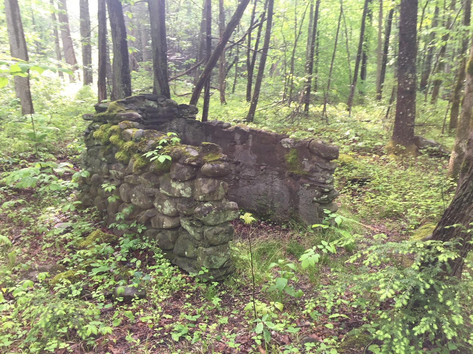


Just a few steps up this roadbed I must have tripped the wire to release monsoon season in the Smokies. Suddenly it was raining so hard I could hardly hold my eyes open for fear of a contact lens being flooded from my eye. It was intense. I tried hiking through it but it was relentless so I sought shelter under the first rock overhang I came to. About twenty minutes later the sun was out and the rain stopped. I'd spend the remainder of the day trying to dry out.


Just a little water on the trail...

From here, I continued on up slightly to a fork in the trail. I go to the right along a stone wall until reaching a nice cascade. My camera was still a little fogged over and wet from the rain so I decided to retrieve my phone from my pack for today's picture taking. As I started to remove my pack, it was as if someone kicked my feet out from under me and I fell stone dead on the rocks. Worst fall I've ever had hiking. I'm amazed I didn't break an arm or something. Too bad no one was there to see that one!


After several pics, I head on to find the Sugarlands Cemetery. It was also at this point I came to realize I wasn't properly prepared for this hike. I wasn't sure which way to go so I picked a trail and went. Although it was a nice trail, eventually it appeared to be leading back to the highway so I turned back and chose another trail that luckily led to the cemetery.


After many, many pics and a while of looking at and reading the old stones in the cemetery, I was off to find the stone house I've heard so much about. Unfortunately, I wasn't very well prepared for that either and wandered aimlessly off-trail for miles. Yeah, it was still pretty damn fun just exploring but I'd like to have found the rock house. Guess I have a good excuse to go back. This area will definitely be on my list of fall/winter hikes this year. There's a lot off exploring to be had here.

Ultimately, with no luck finding the rock house or even the old CCC clock tower, I decided if I was going to hike the rest of the Old Sugarland Trail, I needed to get to it. So I headed back down the old roadbed and turned right back onto the Old Sugarlands Trail. From here the trail climbs rather steeply for the next few miles. This part of the trail is kinda hard and offers little reward as far as sights to see so it would be used mainly by mile markers looking to hike every trail or those on horseback coming from various horse trails in the area.


My original plan was to loop back via the Grassy Branch Horse Trail.
One look at that muddy mess and plans changed fast. Yuck!

After reaching the junction with the Bullhead Trail, its only 6.4 miles on up to LeConte but since I'm not crazy (at least not that crazy!), I turn around to head back out the way I came. It's 3.5 mile from the parking lot to this spot but with all the off-trail meandering, I'm already well over six miles.

On the way down I'm still wondering where that dang blasted rock house is and why I never even saw the old CCC clock tower. Turns out I missed the clock tower most likely because it was already raining steadily when I came through earlier. Fortunately, I didn't miss it this time and I'm soon off-trail wandering again.


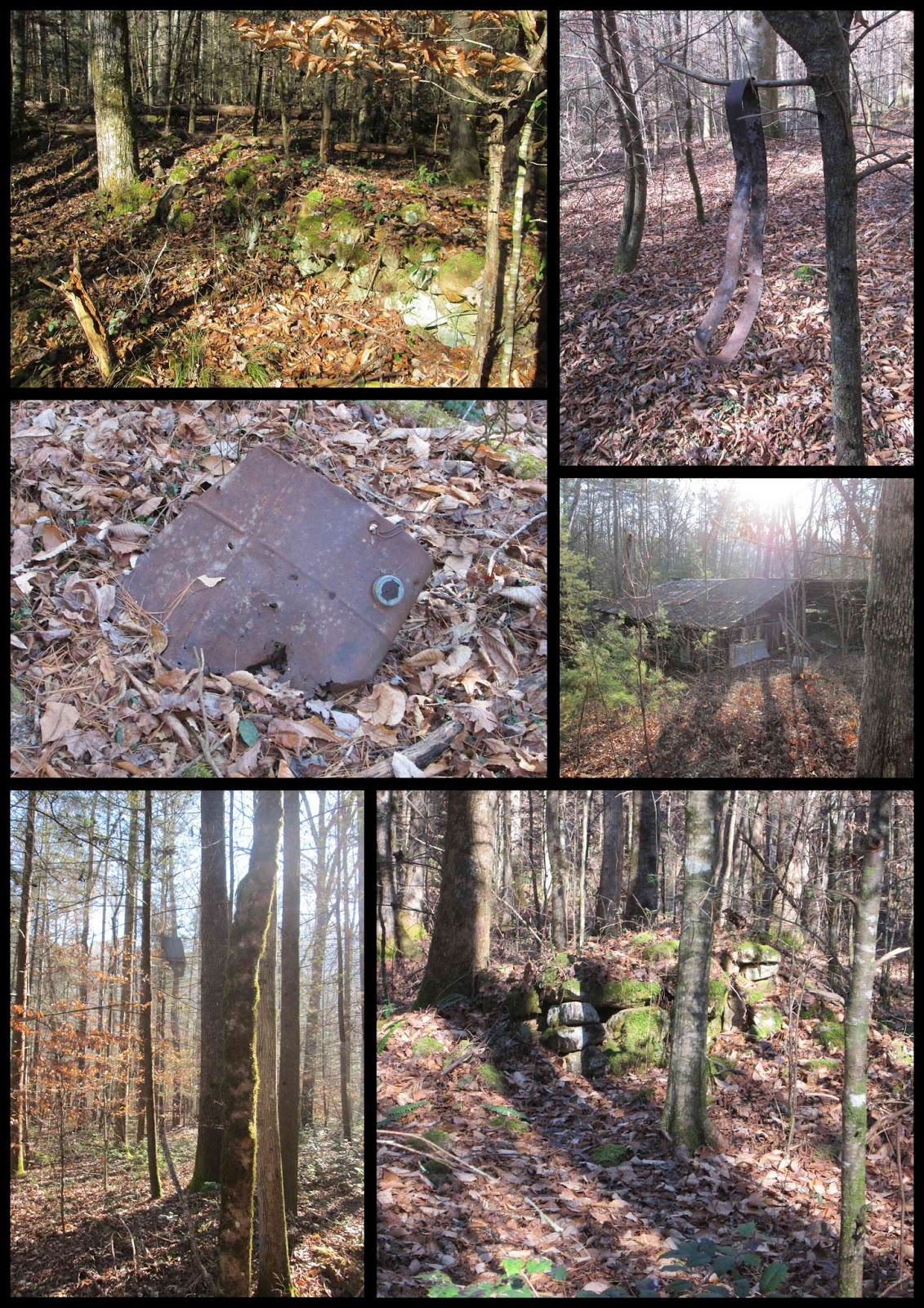
I follow a faint trail from the clock tower to what looks like an old stone flowerbed or possibly where a flag once flew. The trail led to another trail junction of sorts. Left, right and up the bank. I go up the bank first and see stone - the rock house?! - nope. But two impressive large chimneys still standing in all their glory. Magnificent!


From here I start wandering all through the area finding all sorts of cool and strange items...


After getting a little carried away with all the off-trail wandering, I thought I'd better move on before I ran into a snake or who knows what. I can't wait to come back here and I have no idea why it took me so long to do this hike in the first place. Absolutely loved it!

I had great day on and off this trail despite the fact that my foot hurt all day, I never completely dried out from all the rain and my arm took a heck of a blow bouncing off that rock when I fell and then there's the whole not finding what I was looking for thing. But on the positive side, it was all part of a wonderful adventure with many discoveries, a beautiful cemetery and it was also the first hike in about two years where I didn't wear a knee brace. I call that a good day. A good day indeed.

EDIT:

A few weeks after this hike, I enlisted the help of Mr. Eddie Wright along with Randy Hullinger and made a quick trip back up this trail. Eddie, having been to the rock house before, was our guide. Although his confidence was a little shaky at times, we made it!


TRAIL REVIEW

Old Sugarlands Trail - 3.5 miles each way (7 miles round trip)

Various off trail ventures - 5.1 miles


Sugarlands Cemetery

Old CCC camp, etc.


Wanna hike the 900 without getting lost? Start by checking out the book Day Hiker's Guide To All The Trails In The Smoky Mountains by Elizabeth L. Etnier.

Hiking Trails of the Smokies or "The Little Brown Book" from the GSMA


There is loads of information in the pages of GoSmokies.com.

Camel Gap Loop

Hike #35 : April 18, 2015


16 miles
10.2 new miles
457.9 total overall miles
326.0 total miles of 800.8


Since this was a solo hike, I wanted to do a loop. I love loop trails. As I continue along this journey, I'm finding them much more elusive than they used to be. But after looking at the map and referring to Day Hiker's Guide To All The Trails In The Smoky Mountains, I decided on the Camel Gap Trail as it can be connected to the AT and Low Gap trails to form a nice 16 mile loop. And here we go...

The hike begins from the Cosby Campground and meanders a short way along Cosby Creek before reaching to junction with Low Gap Trail. Low Gap is an unrelenting climb for nearly three miles and often over many, many rocks. Make no mistake, it's brutal.


Low Gap Trail

Upon finally reaching the junction with the Appalachian Trail, you'll find yourself at a four way stop. The AT goes left and right while Low Gap continues straight across. Going left here would lead to Mt. Cammerer. Going straight, which was my original plan, would take you down to Camel Gap Trail and going right along the AT also leads to Camel Gap. I decided last minute to go right on the AT. My thought was I'd avoid a possible crowd of thru-hikers by getting along the AT early and plus Camel Gap would be all downhill.

This section of the AT was surprisingly nice with great views on either side as the trail climbs and the elevation tops out around 5000 feet. The trail was muddy from recent rains and an abundance of hikers.


The Appalachian Trail between Low Gap And Camel Gap trails.

After just under two and a half miles, I came to the junction with Camel Gap Trail. For the next five miles or so, its a pleasant downhill walk along the trail. Early on, the trail offers some nice mountainous views to the left.


The view from Camel Gap not far from the AT.

Much of Camel Gap follows along side of Big Creek and that is where a lot of the beauty of this trail comes from. There are many small cascades and water features to marvel.


Around eight miles into the hike, I came across some old relics from when the trail was likely a railroad bed used by lumber companies. Its always cool to connect a trail with the history of the past.


An old wheelset rests in Big Creek

When I reached campsite #36, I stopped for lunch before continuing on to the junction with Low Gap. Some refer to Low Gap as Low Gap I and Low Gap II since its divided in two by the AT. From Camel Gap up Low Gap to the AT is very similar to the pain and suffering of going up Low Gap from Cosby to the AT. Its rough and made even more so with over ten miles already behind you.

Once reaching the AT, its back down the other side of Low Gap to Cosby. The steep decline and rockiness makes the hike down difficult and slow.


View of the AT from Low Gap near the end of a rigorous climb.
All in all, though getting to it is very strenuous, Camel Gap Trail is fantastic! No doubt I'll be returning here again someday. Happy hiking!


TRAIL REVIEW

Low Gap Trail from Cosby to AT - 2.9 miles

Appalachian Trail from Low Gap to Camel Gap - 2.4 miles

Camel Gap Trail - 4.7 miles

Big Creek Trail - .6 mile

Low Gap Trail from Camel Gap to AT - 2.5 miles


Cosby Knob Shelter

Campsite #36

Campsite #37


Wanna hike the 900 without getting lost? Start by checking out the book Day Hiker's Guide To All The Trails In The Smoky Mountains by Elizabeth L. Etnier.

Hiking Trails of the Smokies or "The Little Brown Book" from the GSMA


There is loads of information in the pages of GoSmokies.com.

Mt. LeConte 2015

Hike #33 : April 5, 2015


19.9 miles
8.8 new miles
441.9 total overall miles
315.8 total miles of 800.8


It's been over two months since I last posted on this blog. I've been hiking, just a different kind of hiking, off trail hiking. After meeting Mike Maples on the OST, I was fortunate to get to join him on some truly amazing hikes deep into the woods where few seldom travel. Although I still plan to hike the 900, I'm not like a lot of the map markers out there... I'm in absolutely no hurry.

There's a limitless amount of hiking around here and not just in the park. Then, of course, there are many trails that I enjoy hiking repeatedly: LeConte, Rocky Top, Cammerer, Gregory Bald... just to name a few. So, when I knock off a few miles here or there I'll post them here like always. If I disappear for a spell? Well, I'm probably still out there having fun hiking... somewhere.

And speaking of trails I enjoy repeating, on Easter Sunday I ventured out to solo hike Mt. LeConte for the first time and to complete the fifth trail. There are five trails to LeConte and Trillium Gap is the last one for me. I decided, rather ambitiously I may add, to loop hike it by going up Rainbow Falls and back down Trillium Gap.

Even though the Rainbow Falls trail tried to kill me a few years ago, I do love the trail. Since I've already blogged about it here, I won't go into much detail other than to say it was wet, rocky and muddy throughout. It's a difficult hike, especially the last couple of miles to the top, but I found it less so this time around. Maybe I'm a little bit better hiker now? Maybe.

From the arrival at the lodge, it's about a two mile round trip to visit the Cliff Tops...


and Myrtle Point...


Worth every step. I also have to mention that upon my arrival to the lodge at nearly 11:00 am, I was pleasantly greeted by Dustin Hatfield and his amazing bagpipe rendition of Amazing Grace. That's probably one of those once in a lifetime you had to be there moments and it was off the chart amazing!

Dustin Hatfield playing Amazing Grace!
So after the incredible views, I had my lunch and bought my "I hike it 2015" shirt and headed out to begin my descent down Trillium Gap. The trail begins alongside the far cabins and immediately begins a downward path of rocks and water with just a little ice still hanging around. After all the mountain climbing up, the downward grade is most welcomed. Trillium is a nice trail and it offers many nice views through the trees, at least this time of year. 


The trail varies between being rocky and rooty and even smooth at times. Much like Rainbow, it's a bit of a wet, messy trail at times. If you hike it after a good rain, expect wet feet.

After 3.6 miles, I reached the trail junction with the Brushy Mountain Trail. The sign pointing to brushy mountain reads .2 miles, however the park maps says .4 miles. It's definitely closer to .4 than .2 so be prepared for that should you choose to check it out. I've also previously blogged about this hike here.

So, back to the trail sign. A right turn here would lead down to Porters Creek via the Brushy Mountain Trail but I'll be continuing to the left on Trillium Gap. At about 5.25 miles down the trail, I came to Grotto Falls.


It was here that I finally started seeing other people for the first time since LeConte. This is one of the most popular and easier accessible falls in the park and its easy to see why. The trail actually goes behind and under the waterfall which is pretty darn cool!

From here, the trail continues all the way down to the Roaring Fork Motor Nature Trail. The road is closed in winter and as of this writing is closed due to repair work. About .1 of a mile prior to reaching the road, Trillium Gap actually turns to the left. To get the full mileage, I walk to the road and turn back around to head on down Trillium.

This last 2.3 miles was my least favorite of the day. In fact, it was bordering on mind-numbing. The trail is not hard but it follows the road to the right and is mainly all bank to the left. I guess after 17 or 18 miles I needed more to look at and I was definitely pooped so I was really just ready to wrap things up.

All in all, it was an incredible day. The sights and the overall feeling of accomplishment were amazing. LeConte never disappoints no matter which way you go!


TRAIL REVIEW

Rainbow Falls Trail - 6.5 miles

Trillium Gap Trail - 8.8 miles


Rainbow Falls

LeConte Lodge

Cliff Tops

Myrtle Point

Brushy Mountain

Grotto Falls


Wanna hike the 900 without getting lost? Start by checking out the book Day Hiker's Guide To All The Trails In The Smoky Mountains by Elizabeth L. Etnier.

Hiking Trails of the Smokies or "The Little Brown Book" from the GSMA


There is loads of information in the pages of GoSmokies.com.

Old Settlers Trail (Part 2)

Hike #32, Part 2 : January 24, 2015


300 MILES!!!

15 miles
9.5 new miles
422 total overall miles
307.0 total miles of 800.8


For our second trip to the Old Settlers Trail, Eddie and I will again be doing a car drop. We met at Greenbrier Cove and left a car at the small parking area just across the bridge heading toward the Ramsey Cascade trailhead. We then drove along 321 to the Texas Creek Manway across from Texas Lane. Although our first trip to OST started with an three mile bushwhack, we decided it best to forgo that craziness and use an actual trail this time.

The Texas Creek Manway runs directly off 321 between two rock walls. This is not an official trail nor is it mapped. The trail itself is mostly flat and in pretty good shape, although there are many downed trees along the way but they are easy enough to go around.


Texas Creek Manway

Upon reaching the OST, the trail heads uphill along the creek. For a while here, we are hiking along the same part of the trail we did a few weeks ago but soon we find ourselves on new ground. That new ground was quickly covered in snow. A surprising amount of snow in fact.


One of the first of many chimneys along the Old Settlers Trail

The snow soon went away as we began our way down into lower elevations over the few miles. There are so many wonderful sights along this trail. Rock walls, chimneys, old pieces of stoves and cookware... it's amazing.


This chimney is the Norm Ramsey homestead.
(I know that thanks to Mike Maples)

After 1.8 miles, the manway to Noisy Creek heads to the right. We walked a ways along Noisy Creek and enjoyed the cascading water and what looked like a few past homesteads with rock piles along the bank before heading back up to the OST. About a quarter of a mile farther along, the trail takes a steep climb as we pass Ramsey Creek. Shortly, we come to a large stone wall to the left with a smaller wall to the right.


This is the Homer Reagan homestead.
(Again, I know that thanks to Mike Maples)

A short walk along the wall and we came to a magnificent chimney.


At 4.1 miles, we reached campsite 33, which is also the site of an old homestead itself complete with chimney and more rock piles. On up at about 4.8 miles, there's another unmarked trail to the right that is a wide manway leading to 321. As the trail continues, there's still much to see.


As we made our way along the trail, nearing our next stop at the Frazier Cemetery, we came across something I'd never imagined seeing, a deer. A very dead and mostly eaten deer. We had no idea what killed it but judging by the scat just feet away, we were pretty sure a bear had just enjoyed a hearty lunch.


Bear brunch?


Just beyond the gore, we came to our destination. Another unmarked trail leading right. We take the side trail and it soon splits. To the right the trail heads to 321 and to the left is the trail leading to the Frazier Cemetery.

After returning to the OST, we hit the 6 mile mark when we come to Soak Ash Creek where just before the trail crosses the creek, there are side trail to the left and the right. We took the trail to the left that leads to Green Cemetery. Its just a short walk that leads to a really steep climb but worth it if you're into the whole cemetery thing. The trail to the right may lead to the Doc Green Cemetery but we didn't have time to find out. Maybe another time.

From here, its more uphill climb. About 2 miles of climb until the trail levels out. The OST is such a remarkable trail with its incredible diversity and history but it is not an easy walk through the woods. It can be very strenuous at times and although it is certainly possible to hike it in its entirety in a single day, I would never recommend it. There's too much to see.


With about .3 of a mile to go before reaching the parking lot in Greebrier Cove, we take another off trail walk. This one was a little more hidden but with the leaves down, there's a visible path. I missed it but fortunately Eddie didn't. So we made our way to the Parton Cemetery and back. From here we make our return to the parking lot. 

As we left, we made a quick stop at the Grapeyard Ridge Trailhead and made a half mile round trip to the old Friendship Church site and the Friendship Cemetery.
At the end of the day, I was physically spent as the sun was setting on one of our greatest hikes ever. As an added bonus, I think Eddie has caught the fever to explore more of these off trail adventures. 

I highly recommend that anyone looking to do any adventuring in the Greenbrier area to check out Mike Maples' blog on GoSmokies.com. He is the definitive source for Old Greenbrier and is just a really nice man in general.


A last little collection of some of the old signs of lives past...


TRAIL REVIEW

Old Settlers Trail - 10.7 miles
Various off trail ventures - 6.3 miles

Campsite #33

Frazier, Green and Parton Cemeteries

Numerous homesteads, chimneys, ect.


Wanna hike the 900 without getting lost? Start by checking out the book Day Hiker's Guide To All The Trails In The Smoky Mountains by Elizabeth L. Etnier.

Hiking Trails of the Smokies or "The Little Brown Book" from the GSMA


There is loads of information in the pages of GoSmokies.com.

Old Settlers Trail (Part 1)

Hike #32, Part 1 : January 17, 2015


13.5 miles
7.5 new miles
402 total overall miles
297.5 total miles of 800.8


Today, Eddie and I met at the Maddron Bald Trailhead to do a car drop hike of the eastern half of the Old Settlers Trail. So after leaving a car at Maddron, we head down 321 to find a spot near Texas Creek to park and begin our hike. And then things got... interesting.

There is no pull-off at what we believed to be the Texas Creek manway, only a few businesses across the road. Unsure whether it would be okay to park there, we decided to cruise on down the road where we came to a pull off. I'm not sure why there is a pull-off here but there certainly isn't a trail of any kind, manway or not. So what to do? Ah, let's just throw on our backpacks and head into the woods. We have a couple of maps and my trusty GPS. What could possibly go wrong? (Yes, I actually said that as we headed in...)

Things start off just fine as we make our way along the... uh, whatever you'd call it. The trail-less woods. Stepping over and through the trees and brush, we head northeast toward the OST. Soon, this bushwhack turns sharply uphill and along a steep ridge testing our ankles and balance. This is rough and untamed terrain. I wouldn't really recommend this to anybody but it was extremely challenging and fun in its own way. After a few falls, actually one was more of a four or five foot slide, the climb continues up, through, around and over every sort of hazard the forest could throw at us.

As we continued our steep hike through incredibly thick underbrush and trees, I closely monitored the GPS as we got closer and closer to the trail. Then something strange happened as we reached the trail according to the GPS... there was NO trail. Up until this moment it was all fun and games but suddenly not knowing exactly where the trail was or how far we had to go, things grew a bit somber. There was really nothing to do but stay our course. And we did. Word to the wise: if you happen to have a Garmin GPS and use MapSource to plan your hike, IT IS WRONG! Not a little off, not even a mile off. Completely wrong to the point of being useless. This is the first (and hopefully last) time I've had this happen after over a year's worth of hiking with it. And of course it happened the very first time we decided to go completely off trail. Nice.

Soon we heard water. It had to be Texas Creek. At least we now had some idea of where we were. As I crossed the creek, I came up the bank and there it was. The trail. Thank God! After checking with Eddie's topo map, we figured out where we were and finally began our hike. After nearly 3 miles of off trail madness.

The rewards of hiking the OST were quick and plentiful.


This is a very historically rich trail. It's also a good trail with little in the way of rocks and roots. In the next couple of miles, there is so much to see and so many pictures to take that I can't possibly go through them all. This is easily a favorite trail for me as I love imagining the way things were all those years ago.


Many, many chimneys

There's many of these stone structures along the trail. These were made by the families of the original settlers as a way of marking the now gone homesites

After about a mile, we came across some other hikers. I immediately recognised one as Mr. Mike Maples. Smoky Mountain Guru. We had a very interesting conversation and even got some directions to some cool places we wanted to check out along the trail. Mike's a great guy and I was really honored to meet him. Look him up on facebook or read some of his wonderful stories at Go Smokies.


Me and Mr. Mike Maples

Unfortunately, we didn't follow those directions very well and ended up off trail walking in circles for a while. Not lost... just turned around. The stone walls along this trail are numerous but none equaled to the one shortly before coming to Webb Creek. This wall is between five and six feet tall and seems to run the distance of a football field. Behind it and off trail there are many piles of rock and another wall almost as impressive. The work and time that must have gone into these walls is staggering!


Eddie standing next to the massive stone wall.

At the two mile mark, we come to Webb Creek and the junction with the side trail to the Tyson-McCarter Barn and homesite which is clearly marked. A quick 600ft. walk leads to the barn.


Tyson McCarter Barn

This where we had lunch and lamented the craziness of our first three miles of the day. Returning back to the trail, we are greeted with an uphill climb and the possibility of losing daylight. The trail climbs about 700 feet in just over a mile with more rock walls and piles and piles of rocks everywhere before dropping down for a mile or so and coming to another side trail, marked by a pile of rocks, leading to Maddron Cemetery to the right. From here, its back up for about .3 of a mile to the Maddron Bald junction. Maddron Bald is a wide and smooth downhill gravel roadbed. After a half mile, the Willis Baxter Cabin appears to the left. Its a well maintained home built in 1889. The trail goes another .7 of a mile downhill finishing out the hike.


Willis Baxter Cabin


Signs of life along the way...


TRAIL REVIEW

Off Trail - 3 miles
Old Settlers Trail - 6.3 miles
More off trail - 2.7 miles


Wanna hike the 900 without getting lost? Start by checking out the book Day Hiker's Guide To All The Trails In The Smoky Mountains by Elizabeth L. Etnier.

Hiking Trails of the Smokies or "The Little Brown Book" from the GSMA


Huskey Gap, Little River, Rough Creek, Sugarland Mountain

Hike #31 : December 30, 2014


16.2 miles
12.8 new miles
402 total overall miles
290.0 total miles of 800.8


The weather wasn't exactly cooperating when I hit the trail on this one. So I donned my rain jacket and put on my gore-tex shoes and headed on to the Huskey Gap Trailhead just off Newfound Gap Road about two miles south of Sugarlands Visitor Center.

Huskey Gap Trail is an immediate climb up from the moment you step off the road. Even with a heavy mist in the air, the trail is pretty cool. The grape vines are of all sizes and as plentiful as any trail I've been on. I'm a big fan of the vines, they look awesome tangling around the trees and spiraling over the trail. Add the eeriness of the fog and mist and its quite a show.


The trail continues its 1,300 foot climb until reaching the junction with the Sugarland Mountain Trail at the 2 mile mark. From here the trail levels out for about a half mile before heading downhill towards campground #21 at about 3.7 miles in. From here its uphill for about a quarter mile then down about .2 to the junction with the Little River Trail.

The Little River Trail is a wonderfully pleasant trail. I've previously hiked the upper 2.4 miles of this trail last month and loved it. After turning left onto the trail leaving Huskey Gap, the walk is a slight uphill path passing the junction with Goshen Prong Trail at 1.3 miles and on to campsite #24 at the 2 mile mark. Just before coming to the campsite, the trail seaming ends dropping off into the not so Little River. Since it has been an especially wet week leading up to this hike, I assume the water is higher than normal. I had to wander upstream for a while before finding a safe place to rock hop. There were so many rock hops along this hike, I couldn't possibly recall them all. A very wet day. Continuing less than a quarter mile farther is the junction to Rough Creek Trail to the left.

Rough Creek Trail starts off  with a more inclined climb but still moderate enough. Shortly, the trail once again disappears into the Little River. Walking up and down the bank offered no safe rock hop that I could find. The water was fast and rather deep for wading. There was a large tree that had fallen over the river that looked possible. Without giving it too much thought, I stepped up and took a few steps. Next thing I know, I'm on the other side wondering what the hell I was thinking doing that. Fear of heights and falling be damned on this trip!

A few of the difficult passings including the fallen tree.
Rough Creek continued along the water with many rock hops and began getting steeper as it went. About 1.2 miles in, I learned the reason it's called ROUGH Creek. The trail becomes steep. The trail also becomes gone in several places. Actually washed away down the side of the mountain which happens to be a very steep drop off. I imagine a fall here could be very dangerous. Adding to the overall nastiness are the many, many fallen trees across the trail. I literally had to crawl under some and over others. I was a muddy mess! In hindsight, it was a pretty cool adventure but I doubt I'd want to do it again!

After the last 1.6 mile hike up out of the trail hell of Rough Creek, it was a near religious experience making it to the junction with the Sugarland Mountain Trail.

The first mile of Sugarland Mountain was more uphill than I was anticipating but it was up and down. I stopped for lunch at rock wall with a natural built-in seat before continuing down the last 3 miles. Soon after, the weather took a serious turn and the temperature dropped dramatically. The trees were suddenly iced over and freezing mist was battering my face. Gloves on. After a few miles, the mist died off and the temperature rose again. This is where I got to see a bobcat walk leisurely across the trail in front of me about twenty yards ahead. Wish I could have got a picture but it was gone in a flash. Then the fog rolled in. Big time.

The last 2.5 miles of Sugarland Mountain were a welcomed downhill stroll all the way to the junction with Huskey Gap.

The fog was very dense going back down the 2 miles of Huskey Gap where the hike started. The trail was also a massive pile of mud by this time. The fog added an unexpected element to hiking, an almost eerie feeling. Perhaps I've seen too many late night horror films. Either way, I really enjoyed it.


The trail signs...


TRAIL REVIEW

Huskey Gap Trail - 4.1 miles
Little River Trail - 1.8 miles
Rough Creek Trail - 2.8 miles
Sugarland Mountain Trail - 4.1 miles
Huskey Gap Trail - 2 miles

Campsites #21 and #24

*There's also a small unusual and unmarked campsite with bear cables and all about a mile or so from Huskey Gap on the Sugarland Mountain Trail. I assume it's no longer in use as it doesn't appear on the trail map.


Wanna hike the 900 without getting lost? Start by checking out the book Day Hiker's Guide To All The Trails In The Smoky Mountains by Elizabeth L. Etnier.


Cooper Road Trail, Gold Mine Trail, Cane Creek Trail, Hatcher Mountain Trail

Hike #30 : December 14, 2014


10 miles
9.8 new miles
385.8 total overall miles
277.2 total miles of 800.8


The day started with a beautiful drive along the Foothills Parkway at sunrise.


The hike began from the Abrams Creek Campground off Happy Valley Road on Abrams Creek Campground Road in Tallassee. Parking is just past the ranger station. From here the walk begins at the gate leading to the campground. This is just an easy walk along a smooth gravel road straight through the campground to another gate that is the trailhead to Cooper Road Trail.

Cooper Road Trail is just that, a wide mostly smooth road trail. The trail rises gently as it passes the junction with Little Bottoms Trail that leads to Abrams Falls at 1.3 miles. Around 2 miles, the trail begins to climb more steadily and starts to feel more like a hike than a walk in the woods until nearing the 3 mile mark at the junction with the Gold Mine Trail.


Turning left onto the Gold Mine Trail, the trail begins to get rocky. Big ankle twisters. Goldmine is a rather short .8 mile hike to the park's boundary but don't be fooled, its not the easiest of hikes. Its all uphill until you reach the end at the park boundary and just feet from the Top of the World community. There's a barn just past the boundary on private property. The good news is its all downhill back to the junction.

Once back at the junction, a left turn puts you back on Cooper Road Trail for .4 mile to the junction with Cane Creek Trail. Cane Creek goes to the right and Cooper Road switches back to the right. There's also an unmarked trail that veers off just right of the trail sign. My friend Eddie had told me that it was a well worn trail to a gravesite so I definitely wanted to check it out.

The trail to the grave is steep and narrow in a few places and was very hard to see in others. The fallen leaves made it difficult at times to follow the trail. But taking my time I had minimal trouble finding it. At the end of the trail is a lone tombstone of the twin sons of John and Nola Lail. For more info and some pics, click here.

After returning back to the trail junction, a right turn takes you along the Cane Creek Trail. The trail soon begins a steady downhill climb until leveling out after half a mile or so. From here its a mostly downgrade walk on a mostly, sometimes rocky and often muddy, smooth surface. At 1.3 miles you'll come to the Buchanan Cemetery on the right and up a slight hill.


Continuing on, there are several rock hops as you near the park boundary and plenty of opportunities to get the feet wet. I didn't pass up many of these opportunities much to my dismay. Cold wet feet. I did learn, however, my new hiking shoes dry out quickly. After 2.1 miles, you'll come to the park boundary where you'll find No Trespassing signs. Its obvious the trail goes on presumably to meet up with Ace Gap Trail and Beard Cane Trail. Might have to manway that someday.


The walk back up Cane Creek is slightly upgrade until about half a mile from the junction where the climb starts. At the junction, you'll continue back onto Cooper Road Trail passing a couple of boulders placed on the trail. From here, the trail is steadily climbing.With 9 miles already hiked, the climb feels pretty strenuous. Still, another beautiful trail.

After a long 1.8 miles, you'll come to the Hatcher Mountain Trail junction. The Hatcher Mountain Trail was closed for two years after the devastating EF-4 tornado in the spring of 2011. Though the trail was cleared, the devastation is still very much everywhere you look along this trail. The trail is overgrown and many trees are piled up on the sides while others still stand snapped off and weakened or dead causing many downed trees along the trail. I counted no less than twenty in about a mile and a half. Still, considering the scope of the damage, its amazing the trail is even there anymore.  


At 2.6 miles, Hatcher Mountain junctions with Little Bottoms Trail which leads back to Cooper Road Trail and back to the parking lot. I've already blogged about this portion of the hike here.

Overall, I really enjoyed this hike. It's long and difficult in places and the tornado damage is downright depressing... but what a beautiful day to be blessed with ability to hike. I love these mountains. 

Today's trail signs...


Signs of life along the way...


TRAIL REVIEW

Cooper Road Trail - .9 mile
Gold Mine Trail - .8 mile one way (out & back)
Cooper Road Trail - .4 mile
Unmarked trail to Lail Cemetery - .3 mile one way (out & back)
Cain Creek Trail - 2.1 miles one way (out & back)
Cooper Road Trail - 1.8 miles
Hatcher Mountain Trail - 2.6 miles
Little Bottoms Trail - 2.3 miles
Cooper Road Trail - .9 mile

Lail Cemetery
Buchanan Cemetery


Wanna hike the 900 without getting lost? Start by checking out the book Day Hiker's Guide To All The Trails In The Smoky Mountains by Elizabeth L. Etnier.


For more pictures of my hikes, check out the Smoky Mountain Hikertrash facebook page.