Clingmans Dome to The Road To Nowhere

Hike #27 : October 26, 2014


20.8 miles
15.5 new miles
367.9 total overall miles
260.2 total miles of 800.8


Things started out early for this one. The alarm rang at 4am and I was up and on my way to Clingmans dome for my first (and possibly last) group hike with the Great Smokies Hiking & Adventure Group.

As I arrived a bit early, I had the chance to take in the beginnings of the sunrise. Words and pictures cannot come close to describing how beautiful it was.


After meeting up with the group, we were running a little behind. My first meeting with the group's leader, JD, was less than encouraging as he didn't seem to think I was supposed to be there. At the time, I was a bit taken aback by it, offended really, but perhaps he was right.

Wasting no time we hit the Clingmans Dome Bypass Trail. The group starts off like a bat out of hell as we climb. The views were unbelievable! Unfortunately, every time I would stop for a quick pic, I was being left behind more and more. At least Eddie and another fellow hiker, Jennifer, were hanging back with me, at least for the time being.


I was immediately aware that this wasn't my idea of hiking. To me, if you're not taking the time to enjoy the beauty and peace of where you are, then you could just as well be walking anywhere. I want to see the trail, take pictures and breathe in the magnificence of if all. Don't get me wrong, the group was great. Just eons beyond my comfort zone. They were hiking 3 plus miles per hour. Much too fast for my taste or my abilities.

Still, I'm here and I tried keeping up as we merged onto the AT and down towards Silers Bald. This section of the AT is mostly downhill and really is an enjoyable hike as I've talked about before. So many breathtaking views from either side of the trail.


Honestly, I was starting to feel a little robbed. So many remarkable views and no time to soak them in. But I didn't want to be holding everyone up so on I went... as fast as I could.

At about four miles the trail takes a slight upturn as we made it to the junction with Welch Ridge Trail. I was already trailing behind and again my abilities are questioned. Rightly so, I suppose. But when I took this hike on and even before we started hiking at 7:30, it was said that we were to average 2.5 mph. Fine. I can do that. I've done that. That is not how it went. Not even close.

Anyway, Welch Ridge continues more or less flat for about a mile before descending down to the junction with Jonas Creek Trail about a mile and a half later, We're still moving like the mountains are on fire as the trail ran flat for the next mile and a half before heading up brutally for the next mile after that. And that's where I hit the wall. All the trying to keep up speed hiking caught up to me and I was spent. At 10 and a quarter miles into a 20+ mile hike, I'd used up all my energy. Not good. And I'm not enjoying this. A perfectly beautiful day hiking in the greatest place on earth and I'm miserable. Damn. What have I gotten my fool self into?

The next mile and half was down and up. I'm walking along with Dawn and Eddie at this point when Dawn tripped and took a nasty fall hitting her head. After helping her up, she was good to go. Tough woman. Still, I think she knew it was time to slow down a bit and I was more than happy with that because I was barely keeping up with her as it was. Eventually she ran off and left me when the uphills came. Eddie stuck with me but I was struggling bad when we finally reached the junction with Bear Creek Trail. Here the group breaks in two. Most went on to a side trail for lunch while three of us had had enough of the speed. At the junction, we had lunch and headed on down Bear Creek on our own. It was just me, a young man named Brain with a swollen ankle and Dawn, battered and bruised from her falls. At this point we hiked down the trail at a much more human pace. Bear Creek is a beautiful trail especially with all the fall colors. Brian and Dawn made for good company.


Bear Creek is completely down hill for all of its 5.9 miles. The fallen leaves hide the roots and rocks under foot so tripping was plentiful all day. I'd already blown out my left hiking shoe somewhere in the first several miles tripping over something.

About half way down, the rest of the group caught up with us and we continued down together for a spell but soon separated again. Now, Eddie had joined back up with us wounded misfits. When we met back up with the others, there had been a accident. Somehow, JD had gotten poked in the eye with his hiking pole. There was blood everywhere. It looked bad. Really bad. It was here I learned that Bill, another group member, is a doctor. He was able to examine the eye and determine the eyeball looked unharmed but JD still needed an ER asap. So we all kept hiking. Its amazing that JD was able to continue with one eye while the other was still bleeding badly. Not only that but he was still faster than the rest of us. Pretty sure he's not human. Six miles to go.

When we reached the Lakeshore Trail, we had 2.9 miles to go and we begin an uphill climb. I didn't know what to expect from this trail but soon realized it was a steady climb. As I reached reached the junction with Whiteoak Branch Trail, I couldn't take anymore. I was so exhausted. I'd been walking solo for a while here when Eddie came along to hike the rest the way out with me. At this point, I was doubling over in pain from my back, my legs and my feet were as sore as they had ever been... and I was completely physically and mentally drained. I was also out of water. I guess in my exhaustion, I'd drank much more than I had realized. With 2 miles to go, I felt like a dead man. Eddie shared some water with me and a ways on we ran into another friendly club member named Rusty who was kind enough to give me a whole bottle of water. I hope my gratitude showed because I was deeply thankful.

Every step was painful. The last mile and a half was mostly uphill and the struggle of a lifetime. Without Eddie there with me, I doubt I could have made it. I just wanted to lay down and die. Every fiber of my being was screaming out in agony. This was hell. In my mind, not only did I want off this God forsaken trail, but I never wanted to see another trail in life. I'm done. I quit. Let. Me. Die.

But Eddie was full of encouragement. He was sticking with me so I kept going a little at a time. His patience is remarkable.

When the trail finally leveled out we were almost done. A little less than a mile to go. Without the uphill climb, I was able to keep a steady, albeit extremely slow, pace to the end where we reached the road to nowhere and the tunnel. Walking through the tunnel was cool and the surroundings were typically spectacular. I've never been so relieved to be done with a hike. Walking out of the other side of that tunnel was literally like walking out of hell into paradise. I've never felt so beaten and accomplished at the same time.


In the end, I did what I set out to do. I finished the hike. I finished it in about eight hours and forty five minutes. It was presented as a ten hour hike 7am to 5pm. We started at 7:30 and I finished just after 4. Yet, somehow, I walked away feeling like I failed. I guess group hiking isn't going to work for me. I gotta have fun with this 900 miles or its not worth doing. I may be counting miles but I'm also stopping along the way at every scenic view or whatever else catches my eye.

Still, as I write this, I'm already looking back at it as a positive trip. I learned a few hard (extremely hard) lessons. Made a few new friends and overcame complete and utter exhaustion. What may have looked like a weak attempt to some was one hell of an accomplishment for me. I can live with that.

TRAIL REVIEW

The Appalachian Trail - 3.8 miles
Welch Ridge Trail - 6.3 miles
Bear Creek Trail - 5.9 miles
Forney Creek Trail - .4 mile
Lakeshore Trail - 2.9 miles


Wanna hike the 900 without getting lost? Start by checking out the book Day Hiker's Guide To All The Trails In The Smoky Mountains by Elizabeth L. Etnier.


For more pictures of my hikes, check out the Smoky Mountain Hikertrash facebook page.

Cataloochee Divide

Hike #26 : November 3, 2013


13.2 miles
4.9 new miles
352.0 total overall miles
244.7 total miles of 800.8


I mentioned in my post about The Hemphill Bald Loop that our first attempt at finding Hemphill was an utter disaster. Still, I realize now, that I never actually counted the hike or the miles toward my goal. I suppose I just wanted to forget the whole damn thing. But, what the hell, its almost been a whole year since it happened and, in hindsight, it really wasn't that bad a day...

You ever have one of those days that just starts with so much bad mojo that you know you'd be better served just hiding under a rock somewhere? Well, this was that kind of day.

It began with a heavy dose of marital distress. For future reference, it may not be the best idea to throw on the ol' backpack and go hiking in the middle of a... uh, disagreement with the significant other. So I guess that was strike one.

Still, I met up with Eddie and we were on our way. Aside from my phone blowing up with expletives and threats of bodily harm, the drive was uneventful until we reached Hemphill Road. A twisting turning road that eventually gave way to gravel rising deeper and deeper into banjo country. Just as we were about to give up and turn around we saw the Purchase Road sign. The gate was open and we drove on to the next gate that was closed and locked. D'oh.

We park and start preparing for the hike. Eddie asks if I had programed the trail into my GPS. I always do. Except this time. You see, all that marital mumbo jumbo from the morning was just carried over from the previous day so I never got around to quiet time on the computer routing the hike. Ah, no matter. We know where we're going, right? What could go wrong? Strike two.

Since the gate was closed, we had to walk up a gravel road for 2 miles. That's 2 miles we hadn't planned on and 4 miles added to our hike. It wasn't so bad other than walking directly into sunlight and being on a road is never the best hiking scenario.


Still, we finally made it to the Appalachian Highlands Learning Center and wow... just wow.


The views from the learning center are amazing. I have no idea who works here or when they're even here or what they do but what an office view. Fantastic!


If we had turned around and went home from here, it'd been a better day. But we didn't. We headed off to the trailhead. The trail went in two directions. We basically used an educated guess which way we needed to go and went. We hiked down for a spell and came to a junction. I honestly cannot remember what the trail sign said exactly but we took a right turn. Strike three.

Evidently, I took a picture of the trail sign (below) where we went wrong. Although, honestly, I still don't know what the hell SWAG is and its entirely possible we had already made a wrong turn before we even got here.


Still, as we went along, it was a nice downhill hike in early winter with leaves all around as we made our way. It was such a nice day and the pleasant trail and easy trail were almost clearing the clouds and anger out of mind. It did seem odd though that we kept going downhill. Not that that alone would cause any alarms because lets be honest, the Smokies go up and down no matter where you go. Still, something just didn't seem right.

We finally came to a bit of an opening that kinda sorta made us feel like we were getting somewhere.


There was a small shelter of sorts and a breathtaking view. We hung out here for a little while and even discussed whether we were where we were supposed to be. At this point we had no idea where we were. We just didn't know that.


From here, we continued on downhill. My mind is jumbled from all the events of the day and I'm growing more concerned and frankly, irritated about why we aren't there yet. And there's that nagging feeling that we're lost. Then we start passing houses. Seriously? Houses? That didn't seem right at all. But the trail does run along the Park border so... maybe? Eddie kept saying something didn't seem right. I agreed. And yet, we kept going. 

When we start coming up on a road, we finally get out the GPS and try to figure out where the bloody hell we are. Hmmm... that road up there is Cove Creek Road. Let's have a look at the map. Yep. We just hiked 4.6 miles in the wrong fucking direction. That's just great. Now we have to turn around and hike up that very same 4.6 miles to get back to the learning center where we came from. At this point I am done. I no longer want to be here and my spirit is broke. That made the hike back all that much more painful. Losing it mentally makes for a really bad time. And that's what it was from here on out.

Honestly, the trail itself is a good one and doing a car drop and hiking down to the road would make for a great day of hiking. The views from the Appalachian Highlands Learning Center alone are amazing and well worth the trip. 

In the end, for me, it was just a bad day. Not the trails fault. Hell, I can blame Eddie for us getting lost (and I do, Eddie. Yes, yes, I do) but I can only blame myself for not being prepared and not having my head in the game. And, I suppose, for losing my temper and being an ass. According to Eddie anyway. Another hard lesson learned.


TRAIL REVIEW

Cataloochee Divide Trail - 4.6 miles one way (out and back)


Wanna hike the 900 without getting lost? Start by checking out the book Day Hiker's Guide To All The Trails In The Smoky Mountains by Elizabeth L. Etnier.


For more pictures of my hikes, check out the Smoky Mountain Hikertrash facebook page.

Return to Mt. Cammerer

Hike #25 : October 5, 2014


Mt. Cammerer via The Appalachian Trail from Davenport Gap and down Chestnut Branch


12.4 miles
4.9 new miles
347.1 total overall miles
239.8 total miles of 800.8


Yesterday, I met up with Eddie and Mike for my first return to Mt. Cammerer since March of 2013. That was my first solo hike and the beginning of this wonderful adventure to hike the 900. (You can read about all my mistakes and mishaps on that first hike here.)

We met at the Big Creek Ranger station, dropped a car and headed to the Tennessee/North Carolina border and the beginning of The Appalachian Trail in Tennessee where we began our hike. Just two weeks ago, I was in shorts and short sleeves but this morning finds me in long pants and a jacket. Very nice hiking weather!

Every time I have the pleasure of stepping foot on the AT, its an almost spiritual feeling. There is just so much history and legend about it that I feel a its a honor and blessing to be there.

And so we begin. The trail is well used and maintained and wastes no time getting serious as the incline is immediate and steep. Eddie refers to this as a moderate trail but as we know, he is inhuman. It is, in fact, a strenuous trail. The first 1.2 miles climb around 900 feet before leveling out about .3 mile past the junction with the Davenport Gap Shelter to the right. Its a beautiful morning, although the clouds and fog are still hanging heavy in the air. The trail is magnificent...


At 1.9 miles, we pass the junction to the Chestnut Branch Trail. We'll be taking this trail down, but for now we continue on towards Mt. Cammerer. Right around the two mile mark, the trail again heads up. From here we climb over 2,000 feet in the next 3 miles. Its a really tough climb at points but it didn't seem as hard as the last time when I hiked up Low Gap to the AT. Then there's the views along the way peeking out from behind the trees. The fall colors are starting to show!


At around 3 miles, we come to the junction to the Lower Mount Cammerer Trail to the right. About 1.3 miles beyond that, we arrive at the massive rock that towers over the trail. A short climb up on this rock offers a spectacular view.


There's a lot of steps on this section of the AT. Most seemed spaced far enough apart to be not so intrusive. That changed in the final mile up. The trail gets a little steeper and the steps are coming one after the other. I don't know about anyone else, but I'm not fond of lifting my sore ass legs up on all these steps. But you do what you gotta do! At 5.2 miles in, we reach the junction with the Mount Cammerer Trail.

The next .6 miles to the tower seems a lot longer that it should. I guess a combination of anticipation and the many false summits play a part in that. But alas, the tower comes into view.


When we finally climb our way to the tower, the wind is heavy and ice cold. The views are, as always, breathtaking!


Our early start allowed us the luxury of having the place to ourselves for a while so we snap a few pics and quickly head inside out of the wind for lunch. We were soon accompanied by others including a fellow 900 hiker. We hung out for a good 45 minutes or so just sharing hiking stories before deciding to head out.


We retrace the trail all the way down to the junction with Chestnut Branch where we turn right. Chestnut Branch is immediately a very steep and rocky downhill climb. Me and Mike took turns trying to cripple ourselves tripping over as many rocks and roots as we could along the way. The last mile leveled out into an old road bed used for logging back in the 1930s. There were also several homesites in this area. We discovered a few signs of the past along the way.


The Mount Cammerer Fire Tower is without a doubt one of my favorite spots in all the Smokies. Or the world for that matter. I have to say I was disheartened at the condition of the tower itself. In just the year and a half since I was last there, it has deteriorated rapidly. The door no longer closes. The floor is buckled and even rotting around the doorway. The paint on the outside has all but flaked completely away. I really hope and pray that the Park does not let this beautiful and historic landmark fade away.

Well, that's it for my return to Cammerer. A much more successful hike this time around! A wonderful day of hiking with friends in my favorite place on Earth. Awesome.

Happy trails!


TRAIL REVIEW

Appalachian Trail - 5.2 miles
Mount Cammerer Trail - .6 mile one way (out and back)
Appalachian Trail - 3.3
Chestnut Branch Trail - 2.1 miles

Davenport Gap Shelter


Wanna hike the 900? Start by checking out the book Day Hiker's Guide To All The Trails In The Smoky Mountains by Elizabeth L. Etnier.


For more pictures of this hike, check out the Smoky Mountain Hikertrash facebook page.

Middle Prong Loop

Hike #24 : September 20, 2014


Middle Prong Loop (Middle Prong, Greenbrier Ridge, AT, Miry Ridge, Lynn Camp)


22.4 miles
16.9 new miles
334.7 total overall miles
234.9 total miles of 800.8


When originally considering this hike, I decided it was too ambitious at my current level of hiking. But at 9:30 the night before we were to hike Roundtop Trail, I changed my mind and sent Eddie a text to meet up at Tremont the next morning. He was all too happy with that. Of course, he is insane.

Arriving at Tremont just before daybreak it was clear there had been a bit of wind overnight. Leaves and small limbs scattered to roadway. When reaching the parking lot for the Middle Prong Trail, the air was cool and it was clearly going to be a perfect day to hike.

We begin at the Middle Prong Trailhead and start by crossing a bridge and embark upon a gentle incline up a wide gravel roadway. Here we come to the first trail sign as the trail forks. Thankfully someone was nice enough to Sharpie in an arrow to the left trail indicating it as the Middle Prong. The right trail is the now unmapped Thunderhead Prong Trail.

There's a sign as the trail begins that states this as a gentle quiet walk not requiring hiking shoes. That would depend on how far you wish to take the trail. After a few miles, it gets rather rocky. In less than a half mile, we came to the first waterfall, the Lower Lynn Camp Falls. The falls look like a giant water slide and the pictures I took do it no justice. Beautiful.


Just a short way from the falls, we heard crashing water and walked a few steps from the trail where we came to the second waterfall.


And at less than 3/4 of a mile, we find the third waterfall. This is the multi-tiered Lynn Camp Falls and is simply a magnificent picturesque scene.


All three of these waterfalls are accessible to most anyone. An easy walk out and back and less than a mile and a half round trip.

After the falls, the trail continues its mild incline as it becomes quite rocky. At just under 2 miles, there is a side trail to the right that was marked by a small stack of rocks.


This trail leads just a few yards to a long abandoned rusted out old car that is said to be a Cadillac. I sure can't verify that but it is a cool sight to see in this surrounding.


At 2.3 miles, we come to the trail junction with Panther Creek Trail. We continue on Middle Prong to the right. On up the trail at 3.1 miles, we found the remains of what looked like an old homestead or perhaps a building used by the Civilian Conservation Corps. All that remains is a fallen chimney and the concrete foundation of the long gone shelter.


Nearby, there is also an old railroad rail and what appeared to be part of a stove pipe and logging cable.

At about 4 miles, we came to another subtlety marked side trail to the right. Since someone had gone through the trouble of marking it with a small pile of rocks, we decided to check it out. Just a few yards and we began hearing what sounded like another waterfall. Sure enough, we had stumbled onto the Indian Flats Falls.


Very beautiful. This picture shows the top of the falls. In the opposite direction there are two more falls. There was no clear path leading to the bottom of those falls and since we have many, many miles to go, we decided to skip trying to make our own and returned to the main trail.

In just about a tenth of a mile or so, we come to the trail junction with Lynn Camp Prong Trail and Greenbrier Ridge Trail. Since we're doing the long loop, we continue right onto Greenbrier toward the Appalachian Trail. We'll be circling around and returning to this spot from Lynn Camp later.

Once we start Greenbrier, we leave the rocky roadbed behind and begin the journey up an underused, muddy, rooty, rocky and rather unmaintained trail. This is a deep forest hike and its all uphill. Our surroundings are still beautiful but if you want views and company, this may not be a trail for you. With all the rocks, the 4.2 miles up is very strenuous at times but we finally made it to the AT. We had previously decided to take lunch at the Derrick Knob shelter. I didn't know at the time it would .3 mile straight up but that didn't stop us. So instead of continuing on our destination to the left on the AT, we go right on the AT to the shelter. We were 9.2 miles into our trip when we got to the shelter.


Its a nice shelter and we enjoyed the break. The wind from the night before had brought down tons of nuts from the surrounding trees and the chipmunks were happy to take advantage. As we had our lunch, there were dozens of the little guys running all around harvesting for the winter.

After lunch, we started down the AT and back on track. The AT soon proved to be a difficult climb. We came across a few backpackers and an ATC volunteer hard at work sawing a tree. These guys are amazing. Its hard enough just hiking the trail but they carry saws and hammers and whatever else they might need just to make the trail nicer for the rest of us.

We hiked along the AT for 3.7 miles until we came to the junction with Miry Ridge Trail to the left. Miry Ridge is another forest hike. If you like the peace, quiet and solitude of the mountains, this trail suits the bill. Its often a narrow and unmaintained trail.


As the picture shows, the trail is a bit overgrown in places so dodging the briers was a challenge. I imagine that in winter with the leaves gone, there would be some nice views as the trail continued along the top of the ridge. Still, we got glimpses of some real beauty through the trees.


After two and a half miles, we come to the junction with Lynn Camp Proing Trail. Going right would continue on Miry headed toward Jakes Creek and Elkmont but we're going right on Lynn Camp and heading back toward Greenbrier and Middle Prong. For the next 3.7 miles, the trail meanders mostly downhill through the forest. Eventually the trail turned into a rocky path that my sore feet found most unwelcoming. Finally we come to the junction with Greenbrier and head back the way we came. We ended up with 22.4 under our belts.  Exhausted, I was so happy to get back to the parking lot!

What a great day of hiking and what an accomplishment for us both!

Happy Trails!

TRAIL REVIEW

Middle Prong Trail - 4.1 miles
Greenbrier Ridge Trail - 4.2 miles
Appalachian Trail - 2.4
Miry Ridge Trail - 2.5 miles
Lynn Camp Prong Trail - 3.7 miles
Middle Prong Trail - 4.1 miles

Derrick Knob Shelter


Wanna hike the 900? Start by checking out the book Day Hiker's Guide To All The Trails In The Smoky Mountains by Elizabeth L. Etnier.

For more pictures of this hike, check out the Smoky Mountain Hikertrash facebook page.

Boogerman Loop

Hike #23 : August 29, 2014


9.5 miles
7.5 new miles
312.3 total overall miles
218.0 total miles of 800.8


I was a little concerned  about this trail after reading many of the footbridges were washed out or otherwise destroyed, including one that is believed to be the longest in the park. Last weekend's prediction of heavy rain seemed to make things too risky without more information but after a hot and dry week, today's the perfect day!

After a two hour drive, I arrived at the trailhead to Caldwell Fork Trail where I'll be starting my hike. Just about a mile from the trailhead a bear darted across the road in front of me. Always a good sign! A quick look at the trail and there's the footbridge. Guess I won't be getting my feet wet just yet.


The trail starts off meandering through the woods for .8 mile where it comes to a fork. Staying right would keep you on Caldwell Fork and a left turn starts Boogerman. I decided to go left. Here was the first non-bridged creek crossing. I decided to take my chances and walked across a fallen tree instead of changing into the sandals this early in. No problems.

Almost immediately the trail starts its incline. Its a good trail. Not a lot of roots and rocks and the usual beautiful surroundings of the Smokies. There's an abundance of huge trees all along the trail. Stories abound that Robert Palmer (aka Boogerman) was the most stingy of all the settlers in the Smokies when it came to the timber on his property. It was common and profitable for settlers to sell logging rights but Palmer would have none of that and thus the old growth forest we have here today can be attributed to that fact. Thanks, Boogerman! After just over 2.5 miles, the trail gives me one last massive hill to climb before taking a turn downward. From this point on, the hike is mostly easy to occasional slightly moderate climbs. There are several stone walls, one of which is the biggest I've seen on trail to this point.


Since the trail is relatively short, I decided to check out any and all side trails. Often an unmarked side trail can lead to cemeteries and, as I've said before, I really enjoy that. The first side trail took me steeply up to what actually looked like a grave yard with no graves. No stones, no markers. Just a small round patch of well maintained grass. Hmmmm? After a little post hike research, turns out this is actually the Carson-Messer Cemetery. The second side trail was near a stone wall and a fair distance away I found the second cemetery of the day. This is the Palmer Cemetery. Four unmarked stones surrounded by a serious barbwire fence. I really get the impression that the old Boogerman lived up to his nickname. Pretty cool!


At one point as the trail travels down, it basically walks you directly into a giant hollow tree. Big enough for my 6 foot 2 frame and backpack with room to spare.


At 4.7 miles, Boogerman runs into Caldwell Fork again. To continue the loop you take a right and soon cross a half collapsed footbridge. Since I'm in search of the 900 miles, I turn left up Caldwell to get the half mile to the junction with Big Fork Ridge and McKee Branch. After reaching the junction, I turn around and head down Caldwell Fork again. Someone has been busy cutting the grass along the trail and they've done a tremendous job. One particular fallen tree had been sawed and tagged indicating the age of the tree.


With about two miles remaining on the hike, I come to the next bridgeless water crossing. This time I gladly replace the hiking shoes for sandals and head in. As cold as the water is, it feels amazing on tired hiking feet! Since the trail is winding down, I leave the sandals on and bypass the next several footbridges in favor of wading. About a quarter of a mile from the end of the trail, I spotted a bear cub just a few feet off the trail. As I stopped, it took one look at me and poof, it was gone. I'm always amazed at how they take off in an instant and there's no trace of them, no sound... nothing.


Overall, this is a wonderful trail. I'd say its one of my favorites. I have a lot of favorites. With all the water, I'd recommend it as a summer hike but I'd definitely recommend it!

On a side note, I also recommend a drive around Cataloochee after the hike. The park has put a lot of work into fixing things up and there's a lot to see. Palmer House and exhibit, Palmer Church and cemetery, the Cladwell house, cemetery and barn along with another church and school house all in a relatively small area. Saw a lot of fat turkeys walking around. There's also a lot of Elk signs around but, alas, I still didn't see an elk. Maybe next time.

Happy Trails!

TRAIL REVIEW

Caldwell Fork Trail - .8 mile
Boogerman Trail - 3.9 miles
Caldwell Fork Trail - .5 mile out .5 mile back
Caldwell Fork Trail - 2.7 miles

Cataloochee Campground


Wanna hike the 900? Start by checking out the book Day Hiker's Guide To All The Trails In The Smoky Mountains by Elizabeth L. Etnier.

For more pictures of this hike, check out the Smoky Mountain Hikertrash facebook page.

Meigs Creek

Hike #22 : August 16, 2014


11 miles
10.1 new miles
302.8 total overall miles
210.5 total miles of 800.8


Eddie and I met at The Sinks this morning and dropped a car there and drove on to Elkmont to begin our hike from the Jakes Creek Trailhead. We got close up to a good sized bear along the side of the road just before reaching the parking lot. It's gonna be a good day.

Jakes Creek Trail winds up a partially paved and gravel road for .8 miles before coming to the junction with Meigs Mountain. Jakes Creek Trail continues on up to the left so we merge right onto Meigs Mountain. The trail's is soft and wide as it rolls gently in a mostly downward fashion. I really like this trail. A lot of tall trees and huge vines with very little undergrowth to impede upon the trail. Its August and there's lots of spiderwebs everywhere. I'm pretty sure that's one of the main reasons Eddie wants me in front.


It was somewhere along the way when I saw a partially destroyed hornets nest dangling perilously over the trail. It looked kinda cool so I leaned over to check it out and maybe snap a quick picture when I noticed movement. I looked at Eddie and said there's still bees in... ouch. My first hornet sting in 43 years of living comes from a partially destroyed nest several miles into the forest. Awesome. As we quickly made our way on down the trail away from the bees, we came to our first cemetery of the day. A small community cemetery with rudimentary stones and sunken graves which as far as I can tell is called Meigs Mountain Cemetery. We snap a few pics and I complain about the pain my buddy the bee gave me in my upper right back and we continue on.


At the five mile mark of Meigs Mountain, we come to the junction with Meigs Creek Trail and take a right. This trail is a complete change of environment for us. We go from dry with little undergrowth to wet with tons of undergrowth including lots of briers and my old friend the stinging nettles. This will also be forever remembered as the trail where I saw my first copperhead on a trail. I stepped right over it but fortunately Eddie saw it and yelled something along the lines of WHHHOAAOONNGHHH! and we stopped and gawked at for a while. Beautiful little creature.


We counted a total of 22 water crossings on this trail and I'd say there would be even more after a heavy rain. I think it was after the 16th or 17th crossing that with noticed a waterfall. This was a particularly good treat since neither of us knew there was going to be a waterfall at all. Turns out its called Upper Meigs Falls or Meigs Creek Cascades but either way it is pretty spectacular.


After slipping on a rock and getting my foot wet, I decided what the heck and waded on in. The water was cold and felt terrific! The highlight of the hike. Next time I'll bring extra clothes and get under the waterfall. That would have to feel amazing after hiking for hours!

After leaving the falls, we decided to leave our water shoes on and wade the rest of the water crossings. That was a lot of fun and feeling that cold water on your tired feet is wonderful. Just 1.7 miles from the falls, we come to The Sinks and another incredible day of hiking comes to a close. Probably the easiest overall trail Eddie and I have done together and a perfect hike for a hot summer day. Very highly recommended, even just a quick mile and a half to the waterfall from the sinks and back would be a great and time worthy trip.


We did take an extensive tour of Elkmont after finishing up the days hike. The Elkmont Cemetery is a rather large one and well maintained. We also visited the site of the Elkmont Hotel and Wonderland Resort along with several historic cabins. Loved it. So to sum it all up, I looked a bear in the eyes, saw a copperhead, wore hundreds of spiderwebs, got stung by a hornet, saw lots of graves and enormous vines and got my feet wet. That's a day worth living!

Happy Trails!

TRAIL REVIEW

Jakes Creek Trail - .8 mile
Meigs Mountain Trail - 6.0 miles
Meigs Creek Trail - 3.5 miles

2 campsites (19, 20)
Elkmont Campground

Wanna hike the 900? Start by checking out the book Day Hiker's Guide To All The Trails In The Smoky Mountains by Elizabeth L. Etnier.

For more pictures of this hike, check out the Smoky Mountain Hikertrash facebook page.


Grapeyard Ridge Trail

Hike #21 : July 5, 2014


Baskins Creek to Grapeyard Ridge Trail


200  MILES!!!


11.8 miles
10.3 new miles
291.8 total overall miles
200.4 total miles of 800.8


Eddie and I got a nice cool early morning start today but were quickly thwarted by a slight error that turned out very well. Confused? So were we.

The original plan for today was to drop a car in Greenbrier and another at the Noah "Bud" Ogle Home parking area and hike the Twin Creeks Trail before moving on to Baskins Creek. Instead, we hiked the Noah "Bud" Ogle nature trail which was actually a very pleasant and short hike at only 3/4 of a mile. The confusing part was that we thought we were hiking the Twin Creeks Trail. As it turned out, the distance between the actual Twin Creeks Trail and Baskins Creek Trail is over half a mile straight up the paved road. That would not have been fun and I'm so not disappointed that we missed it.

After our nature trail side trip, we hit the Baskins Creek Trailhead on the Roaring Fork Motor Nature Trail and begin our hike. The trail takes off pretty quickly as it winds its way downhill. Its a soft trail with few roots and almost no rocks. At 1.1 miles, there's a side trail to Baskins Creek Cemetery. I've got a thing for cemeteries, so we take the trip up. Way up. Its a short walk but seriously straight up. I'd suggest taking this side trip only if you have a morbid fascination with cemeteries. Like I do.


After returning to the trail, we come to the side trail leading to Baskins Creek Falls just a quarter of a mile later. This trail is a nice well used trail also going downhill for the most part. Sweet! The falls are awesome. I've read that the settlers used to use these falls to take showers and baths. After seeing it, there's no doubt. A quick and easy climb to the middle of the falls reveals what honestly looks like a bathtub. I imagine the water to be a bit cold, so I'll wait to bathe at home... but it was tempting!


The hike back out to Baskins Creek Trail is the first real challenge of the day but still only moderately so. After rejoining the trail, we have about 1.3 miles back to the Roaring Fork Motor Trail where we'll cross the road to get to Grapeyard Ridge Trail. But first we're treated to another cemetery, Bales Cemetery. Unfortunately, it was closed for repair work but we still got a good look.


Then on to Grapeyard...


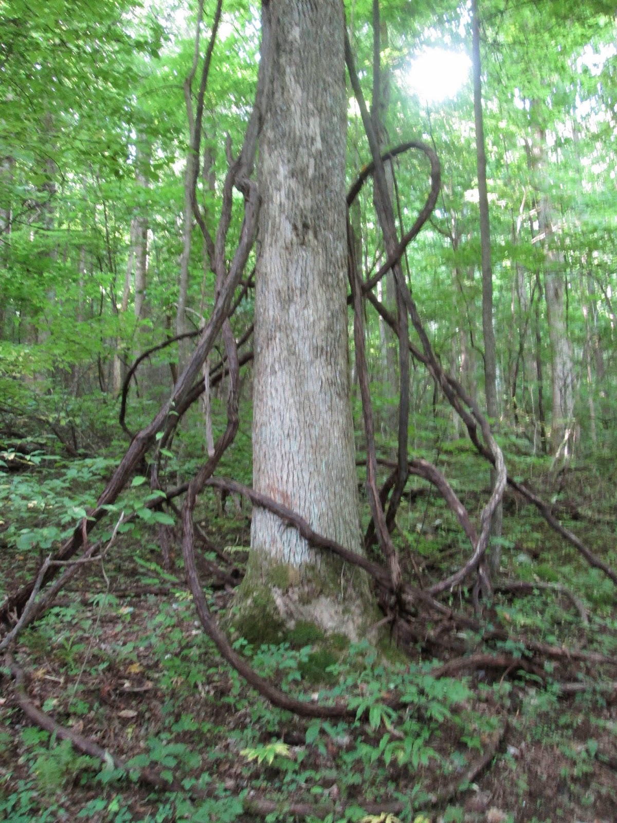
Grapeyard begins as a walk through a field past a cabin, barn and corn crib once belonging to Alex Cole. Once we enter the woods, the trail greets us with a promised steady incline. There's many huge vines along this trail that I later discovered were grapevines. Guess that explains the name of the trail. After the long climb up, the trail levels somewhat and begins rolling up and down through the forest. At 4.4 miles we came to campsite 32 where Eddie spotted a deer. Another .4 miles up and we reached the the sight of the lumber company steam engine wreck of the1920s. Seems the driver lost control and the engine rolled down into the creek which was then named Injun Creek. Seems some folks think it was named after Native Americans in the area but the truth is that its actually just a misspelling of 'Engine' Creek. Since its a creek... with an engine in it.


After lots of pictures of the wreck site, we head on out. Its 2.8 miles back to the truck from here. About a quarter mile out, I gave Eddie a surprise by jogging the rest of the trail. Surprised me, too. Just another wonderful day spent in one of the greatest places on earth. Happy Trails!

TRAIL REVIEW

Baskins Creek Trail - 2.7 miles
Grapeyard Ridge Trail - 7.6 miles

1 campsite (32)


Wanna hike the 900? Start by checking out the book Day Hiker's Guide To All The Trails In The Smoky Mountains by Elizabeth L. Etnier.

For more pictures of this hike, check out the Smoky Mountain Hikertrash facebook page.